September 2, 2026 · The Geography Traveler
Acadia's Coastline: Reading Tide Pools, Cliffs & Glacial Geology Before You Visit
Acadia is the rare park where two completely different geologic stories are stacked on top of each other — one written in fire, the other in ice. Knowing which is which changes what you see the moment you step onto the rocks.
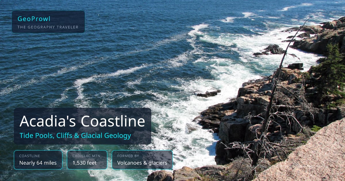
How Acadia Was Made
The NPS describes Acadia as "a place forged in the fire of ancient volcanoes and carved by ice" — two separate events, far apart in time. Ancient volcanic activity built the underlying granite and other rock long before the landscape looked anything like it does now. Much later, glaciers moved across that rock, grinding down peaks, rounding off ridges, and carving the valleys and coastal shape you see today. Acadia now protects roughly 50,000 acres and nearly 64 miles of coastline across Mount Desert Island, the Schoodic Peninsula, Isle au Haut, and smaller islands.
Reading the Tide Pools
Tide pools are their own kind of pre-trip literacy — you have to understand the tide schedule to see them at their best. As the tide goes out, water gets trapped in shallow rock basins along the shore, stranding small sea creatures until the tide returns. Look for periwinkle snails, hermit crabs, sea stars, and anemones clinging to the rock walls of each pool. Always check a local tide chart before heading out — the same rocks that are an easy walk at low tide can be cut off fast as the water comes back in.
Cadillac Mountain
At 1,530 feet, Cadillac Mountain is one of more than 20 mountains in Acadia that rise directly from the sea — a striking pattern once you know to look for it, since most coastlines are flat right up to the water. From October 7 to March 6 each year, Cadillac Mountain is the first place in the continental United States to see the sunrise, a seasonal fact tied to the Earth's tilt and the exact shape of the coastline, not a year-round claim.
Before You Go
The same habit from the first post in this series applies directly here: trace the water before you arrive. Acadia's coastline isn't random — it's the direct result of glaciers meeting a volcanic coast, and once a kid knows to look for the difference between rounded, ice-smoothed rock and the sharper volcanic rock underneath, the whole shoreline becomes readable instead of just scenic. See why geographic literacy changes what kids notice on a trip.
Test What You Know
Try Recon Photos to see how well your family knows Maine and every other state from real National Park Service imagery, or check GeoProwl Daily for today's clue-based challenge. See how Acadia compares to six other parks in the full national park comparison guide.
Frequently Asked Questions
How big is Acadia National Park?
Acadia preserves approximately 50,000 acres along the mid-coast of Maine, including nearly 64 miles of coastline across Mount Desert Island, the Schoodic Peninsula, Isle au Haut, and other islands.
How was Acadia's landscape formed?
Two forces, in sequence. Ancient volcanic activity built the underlying rock long ago; much later, glaciers carved and smoothed that rock into the rounded mountains and U-shaped valleys visible today. The NPS describes it as "a place forged in the fire of ancient volcanoes and carved by ice."
How tall is Cadillac Mountain?
1,530 feet — the tallest point on the US Atlantic coast north of Rio de Janeiro, and one of more than 20 mountains in Acadia that rise directly from the sea.
Is Cadillac Mountain really the first place in the US to see the sunrise?
Only seasonally. From October 7 to March 6, Cadillac Mountain is the first place in the continental US to see the sunrise. Outside that window, the claim doesn't hold — the exact first spot shifts with the seasons because of the Earth's tilt and the shape of the coastline.
What should kids look for in Acadia's tide pools?
Tide pools are most active and easiest to explore during low tide, when receding water strands small sea creatures in shallow rock basins. Look for periwinkle snails, hermit crabs, sea stars, and anemones clinging to the rock — and always check a local tide chart before you go, since incoming tides can cut off access to outer rocks quickly.