September 1, 2026 · Geography Explained
Does Pennsylvania Touch the Ocean?
No — Pennsylvania has no coastline on the Atlantic Ocean. It's the only one of the original Thirteen Colonies that doesn't border the ocean directly. But it isn't landlocked, either. The Delaware River and Delaware Bay carry a tidal, ocean-connected waterway right through Philadelphia — deep enough for actual ocean-going ships to reach the Port of Philadelphia, more than 100 miles inland. Here's exactly how that works, and what all the water-body vocabulary along the way actually means.
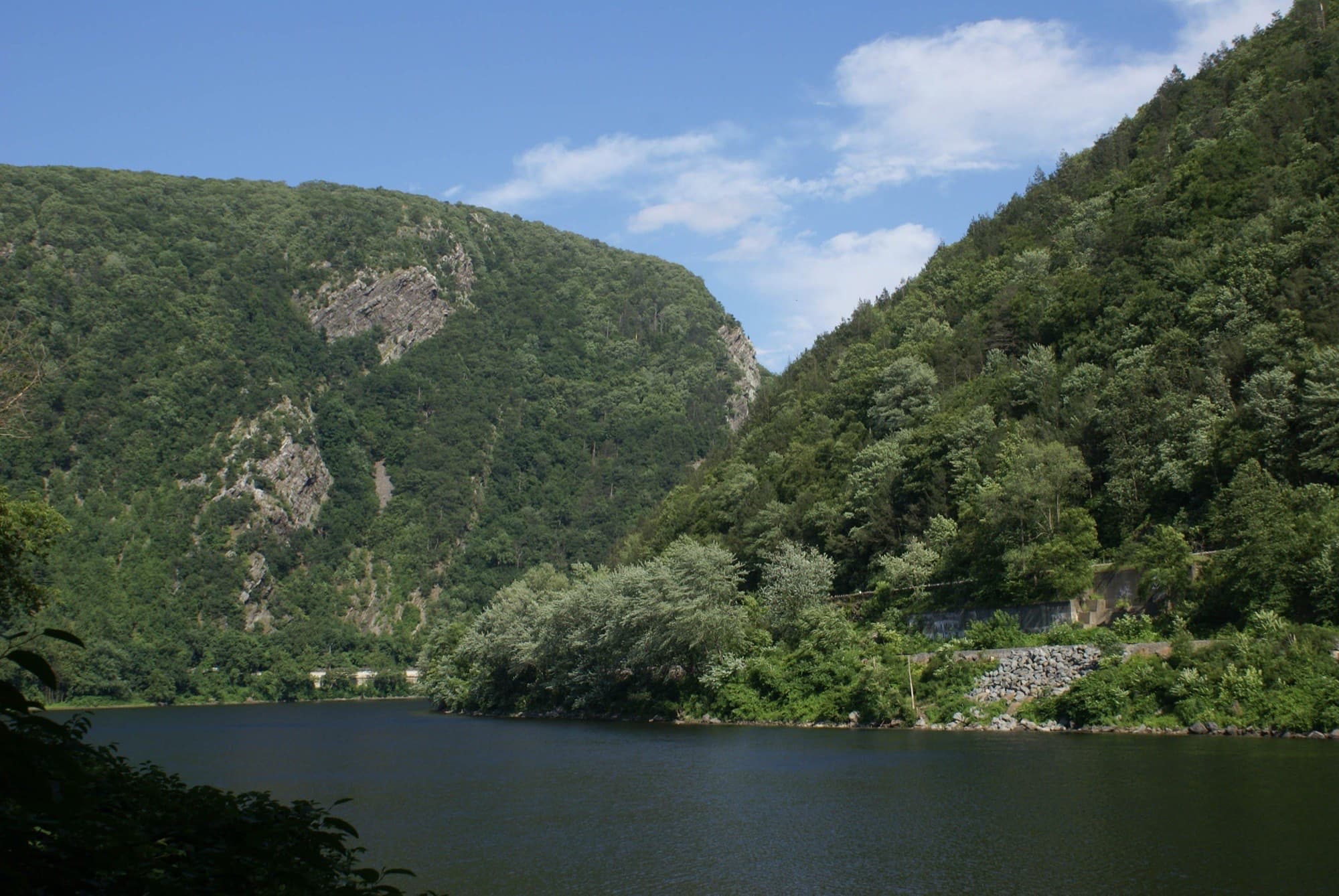
The Delaware Water Gap, where the Delaware River cuts through the Kittatinny ridgeline on the PA/NJ border. Photo: Courtesy of James Hicks / NPS, Delaware Water Gap National Recreation Area.
The Port of Philadelphia, the Delaware River, and Delaware Bay
Pennsylvania's entire southeastern edge follows the Delaware River, which starts as a mountain stream in the Catskills of New York and picks up tributaries — the Lehigh, the Schuylkill — on its way south. By the time it reaches Philadelphia, it's a wide, tidal, fully navigable river, even though the water is still fresh. It stays tidal all the way to Trenton, NJ, about 134 miles from the river's mouth.
South of Philadelphia, the river widens into Delaware Bay — a roughly 782-square-mile stretch where Delaware River freshwater mixes with Atlantic saltwater, opening onto the ocean near Cape May, New Jersey and Cape Henlopen, Delaware. That mixing is exactly what makes it, technically, an estuary (more on that below) even though everyone calls it a bay.
The Port of Philadelphia — PhilaPort — sits about 103 river miles from the open Atlantic, and it's a real, working deep-water seaport. Between 2010 and 2017, the Army Corps of Engineers dredged the Delaware River's shipping channel from 40 to 45 feet specifically so that fully loaded ocean-going cargo ships could sail directly from the Atlantic, up the bay and the river, to Philadelphia's terminals — no smaller feeder ships required.
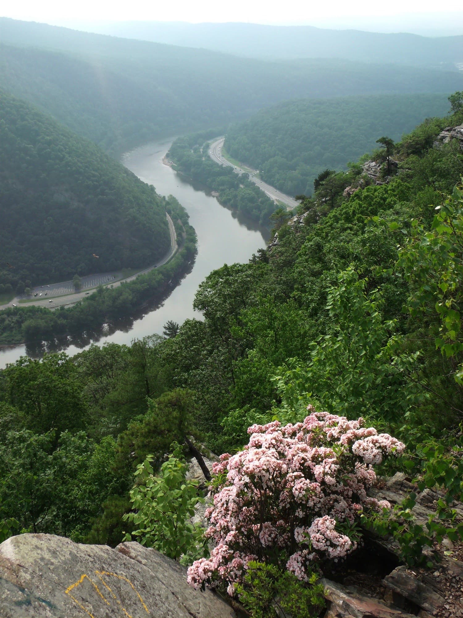
The Delaware River seen from Mount Tammany — the same channel that stays tidal and navigable all the way to Philadelphia. Photo: NPS, Delaware Water Gap National Recreation Area.
"Touches the ocean" vs. "has ocean access"
These sound like the same thing, but they're not — and the difference is the whole answer to this article's question.
- Touches the ocean means a state or country has a coastline directly on open ocean water. Pennsylvania fails this test — its border never reaches open Atlantic water.
- Has ocean access means a state is connected to the ocean by a tidal, navigable waterway that oceangoing vessels can actually travel. Pennsylvania passes this test, via the Delaware River and Bay.
That's also why Pennsylvania doesn't show up on lists of landlocked US states — landlocked specifically means no ocean access at all, by any route. Pennsylvania has real, working ocean access; it just doesn't have a coastline.
What actually separates a bay from a gulf, or a creek from a stream?
Most of these terms don't have one clean scientific definition — they're a mix of hydrology, local naming convention, and history. A few genuine distinctions are worth knowing before you get to the full glossary below.
Bay vs. gulf vs. cove — all three are indentations where the coastline curves inward, and the difference is mostly scale and how enclosed the opening is. A gulf is typically larger and more deeply recessed than a bay; a cove is small and tightly sheltered. There's no hard cutoff between them — Delaware Bay could just as easily have been named a gulf.
River vs. stream vs. creek vs. brook — hydrologists use "stream" as the umbrella term for any flowing fresh water, with river, creek, and brook describing decreasing size. But which word gets used where is mostly regional habit: Brandywine Creek, near Wilmington, Delaware, carries more water than plenty of things called "river" elsewhere in the country.
Canal is the one clean exception on this whole list — it's the only entry that's defined by being human-made rather than natural. The Chesapeake & Delaware Canal, connecting Delaware Bay to the Chesapeake, is a real canal; the Delaware River next to it is not.
Lagoon vs. estuary — both are shallow, partly enclosed coastal water, but a lagoon is defined by a physical barrier (a sandbar or barrier island) separating it from the open sea, while an estuary is defined by fresh and salt water mixing under tidal influence. A body of water can be shaped like a lagoon and still not qualify as an estuary if no river feeds it.
Fjord is the most specific term here: it requires glacial origin. A narrow, steep-walled inlet only counts as a fjord if a glacier carved it before the sea flooded in — which is why fjords cluster in places like Norway and coastal Alaska, and don't occur naturally anywhere near Pennsylvania.
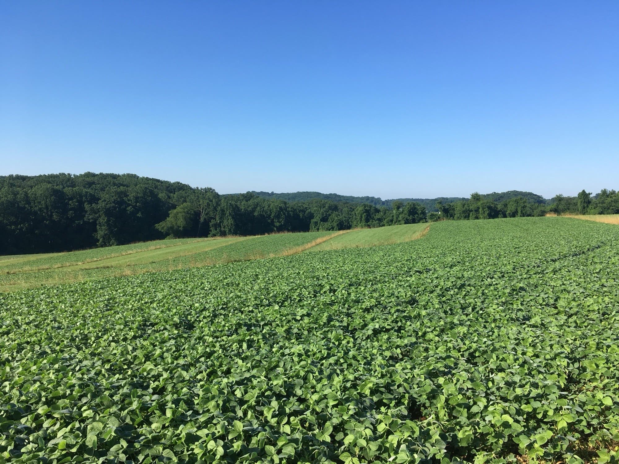
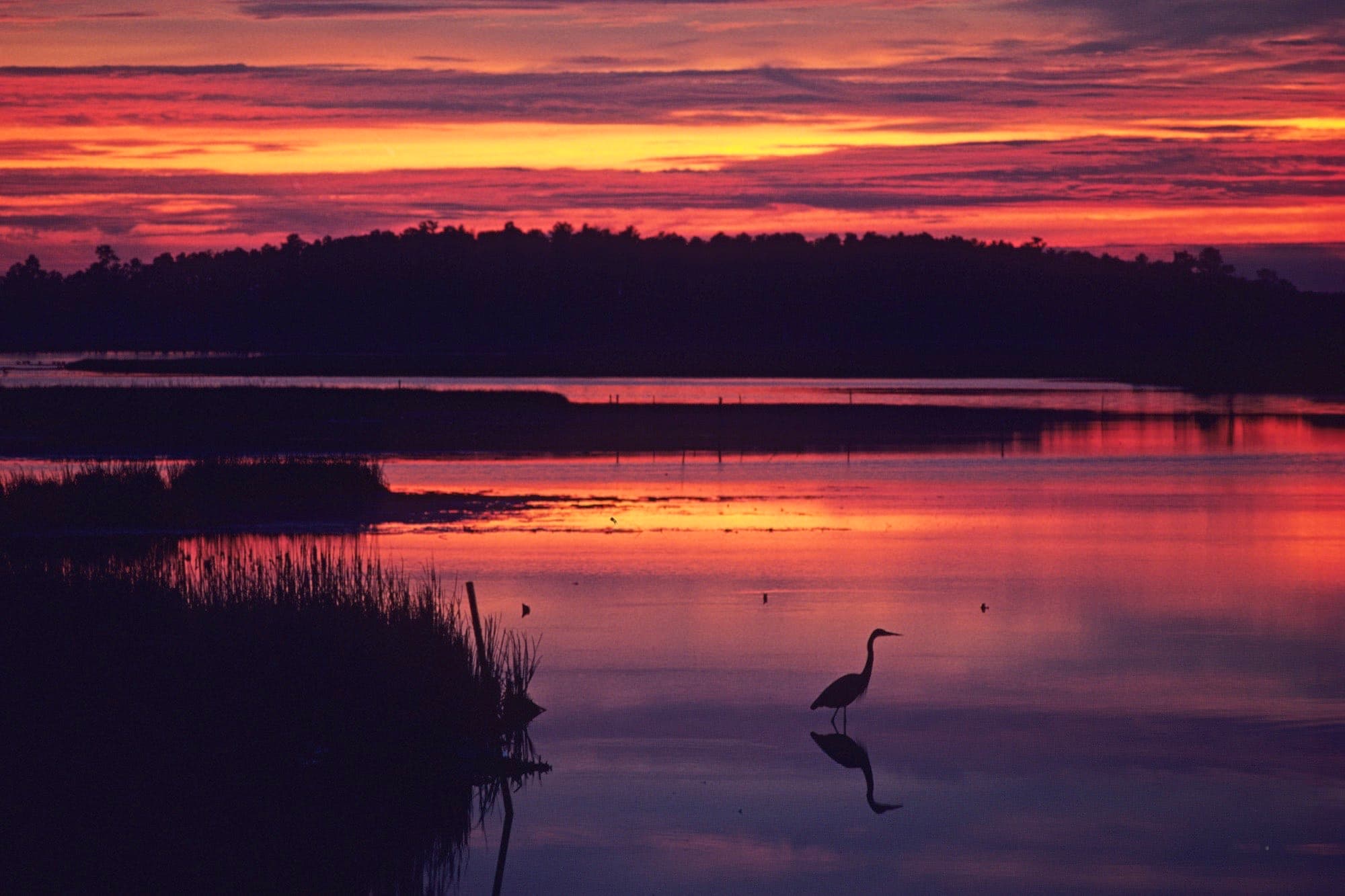
Left: the Brandywine Valley, a creek-fed tributary landscape near First State National Historical Park. Right: a tidal salt marsh at Blackwater National Wildlife Refuge — the same kind of wetland found along Delaware Bay's shoreline. Photos: NPS.
Illustrated: every type of water body
28 terms, one icon each, grouped by category. These same icons show up as answer choices in the trivia game below the glossary.
Ocean & Sea
Coastal Features
Flowing Fresh Water
Still Fresh Water
Land & Drainage
Wetlands
What is a watershed?
A watershed — also called a drainage basin — isn't a body of water at all. It's a land area: every acre of ground where rain and snowmelt eventually drain into the same outlet, whether that's a single stream, a lake, or a bay. Ridgelines and hilltops act as the dividers between watersheds; every point of land on Earth belongs to exactly one watershed at any given scale.
The Delaware River Watershed covers about 13,500 square miles across parts of Pennsylvania, New York, New Jersey, and Delaware — every creek, brook, and tributary in that footprint eventually reaches the Delaware River and, from there, Delaware Bay and the Atlantic. That's the mechanism behind everything in this article: rain falling on a Pocono Mountain hillside in Pennsylvania is, a few hundred miles later, part of the same water flowing past the Port of Philadelphia and out to sea.
Test yourself
Name That Water Body
15 rounds pulled straight from the glossary below — pick the matching icon, then see the definition.
Play Name That Water Body →Full glossary
Every term from the infographic above, plus a few related concepts that come up along the way.
Ocean & Sea
- Ocean
- One of Earth's five vast, interconnected saltwater bodies, covering about 71% of the planet's surface.
- Sea
- A large body of saltwater, usually partly enclosed by land and connected to an ocean, though the term is applied loosely worldwide.
The largest scale of saltwater body — every bay, gulf, and sea is ultimately an arm of, or a connection to, an ocean.
e.g. The Atlantic Ocean
Smaller and more enclosed than an ocean, but bigger and more open than a bay or gulf.
e.g. The Sargasso Sea, bounded by ocean currents instead of land
Coastal Features
- Bay
- A body of water partially enclosed by land, with a wide mouth that opens onto a larger sea or ocean.
- Gulf
- A large body of water partially enclosed by land, generally bigger and more deeply recessed into the coastline than a bay.
- Sound
- A long, wide inlet of the ocean that runs parallel to a coastline, often separating it from a barrier island.
- Strait
- A narrow, navigable channel of water connecting two larger bodies of water.
- Channel
- A broad waterway connecting two seas or oceans, or the deeper navigable path within a river, harbor, or strait.
- Lagoon
- A shallow body of water separated from the open sea by a natural barrier, such as a sandbar or barrier island.
- Fjord
- A long, narrow, steep-sided inlet carved by a glacier and later flooded by the sea.
- Estuary
- A partially enclosed coastal water body where freshwater from rivers mixes with saltwater from the ocean, with salinity rising and falling with the tide.
- Delta
- A fan-shaped landform built from sediment a river deposits as it slows down entering a larger body of water.
- Harbor
- A sheltered stretch of coastal water, natural or built, deep and protected enough for ships to anchor or dock.
- Inlet
- A narrow strip of water leading from a larger body of water inland, into a coastline or between islands.
- Cove
- A small, sheltered, often crescent-shaped coastal or lake inlet, smaller than a bay.
A broader, more open mouth than a gulf. Many bays — including Delaware Bay — are also estuaries where a river meets the sea.
e.g. Delaware Bay
"Gulf" vs. "bay" is mostly naming convention and scale, not a strict scientific line.
e.g. The Gulf of Mexico
Broader and more open than a strait; usually runs alongside the shore rather than cutting through it.
e.g. Long Island Sound
Defined by narrowness and its job as a connector, not by the size of the water itself.
e.g. The Strait of Gibraltar
Often wider than a strait between major bodies; also used for the dredged navigable route inside any waterway.
e.g. The Delaware River's dredged, 45-foot-deep shipping channel up to Philadelphia
Shallow depth plus a physical barrier — unlike an estuary, which is defined by fresh/salt water mixing, not a barrier.
e.g. The lagoons behind North Carolina's Outer Banks
Glacial origin and a U-shaped cross-section — the key thing separating it from an ordinary inlet or strait.
e.g. Tracy Arm, along coastal Alaska
Defined by fresh/salt mixing and tidal influence — not by shape or name. A body can be named "bay" or "river" and still be, technically, an estuary.
e.g. Delaware Bay, officially the Delaware Estuary
A depositional landform, not open water — often braided into multiple distributary channels.
e.g. The Mississippi River Delta
Defined by function — a safe anchorage — rather than by shape; can be a natural bay or an artificial basin.
e.g. Philadelphia's harbor along the Delaware River waterfront
A generic term for any narrow entry point of water into land — it overlaps with strait, cove, and channel.
e.g. The barrier-island inlets along the New Jersey shore
Its small scale and rounded, sheltered shape are what separate it from a bay.
e.g. The small coves along the Chesapeake Bay shoreline
Flowing Fresh Water
- River
- A large, natural channel of flowing freshwater moving toward an ocean, sea, lake, or another river.
- Stream
- The general scientific term for any flowing body of water — rivers, creeks, and brooks are all streams.
- Creek
- A small to medium natural stream, smaller than a river — common terminology in the eastern and midwestern US.
- Brook
- A very small, often shallow, fast-moving stream — typically headwater-sized.
- Tributary
- A stream or river that flows into a larger river or lake, rather than directly into the sea.
- Distributary
- A branch that flows away from a river's main channel, typically in a delta, instead of joining it.
- Canal
- An artificial, human-made waterway built for navigation, irrigation, or moving water between basins.
The largest scale of flowing freshwater channel — though the line between "river" and "creek" is regional naming, not a fixed size.
e.g. The Delaware River
The umbrella term hydrologists use, as well as a specific mid-size watercourse in everyday speech.
e.g. Any of the thousands of named streams that feed the Delaware watershed
Purely a naming convention versus "stream" or "brook" — no fixed hydrological threshold sets it apart.
e.g. Brandywine Creek, near Wilmington, Delaware
Generally the smallest named flowing-water term, most common in the northeastern US.
e.g. The small Pocono Mountain brooks that feed the upper Delaware River
Defined by its relationship to a bigger receiving waterway, not by its own size.
e.g. The Schuylkill River, a major tributary of the Delaware River
The reverse of a tributary: water leaves the main channel rather than adding to it.
e.g. The Atchafalaya, a distributary of the Mississippi River
The only entry on this list defined by being engineered rather than natural.
e.g. The Chesapeake & Delaware Canal, linking Delaware Bay to Chesapeake Bay
Still Fresh Water
- Lake
- A large, inland body of standing (non-flowing) water, typically fresh, surrounded by land.
- Pond
- A small body of standing water, generally shallow enough that sunlight reaches the bottom throughout.
- Reservoir
- A natural or (usually) artificial lake used to store water — typically created by damming a river.
Standing rather than flowing water; usually bigger and deeper than a pond, with no strict cutoff between the two.
e.g. Lake Erie
Smaller and shallower than a lake, often with rooted vegetation across its whole surface.
e.g. Walden Pond, Massachusetts
Defined by its storage/management purpose behind a constructed dam, versus a naturally occurring lake.
e.g. Blue Marsh Lake, a reservoir in Berks County, Pennsylvania
Land & Drainage
- Watershed
- The entire land area that drains — "sheds" — all its rain and snowmelt into one common outlet, such as a river or bay.
A land area defined by topography and ridgelines, not a body of water itself. Every point of land belongs to exactly one watershed at a given scale.
e.g. The Delaware River Watershed, spanning parts of PA, NY, NJ, and DE
Wetlands
- Marsh
- A wetland dominated by grasses and reeds, frequently or continually flooded, often at the edges of a coast or river.
- Swamp
- A wetland dominated by woody trees and shrubs, seasonally or permanently flooded.
- Wetland
- The umbrella term for any land saturated or covered with water — permanently or seasonally — that supports water-adapted plants.
Soft-stemmed vegetation, not woody trees, is what separates a marsh from a swamp. Can be fresh or salt (tidal).
e.g. The tidal salt marshes along Delaware Bay
Woody plants — versus a marsh's grasses — typically along a slow river or low-lying forest.
e.g. The Great Dismal Swamp, Virginia/North Carolina
The broad category; marshes, swamps, bogs, and fens are all subtypes distinguished mostly by vegetation and water source.
e.g. Delaware Bay's Ramsar-designated tidal wetlands
Related terms
- Headwaters
- The source, or starting point, of a river or stream — typically small tributaries high in a watershed.
- Mouth (of a river)
- The point where a river empties into another body of water — an ocean, sea, lake, or another river.
- Tidal river
- A river, or the portion of one, whose water level and current rise and fall with ocean tides — even where the water itself is still fresh.
- Brackish water
- Water with salinity between freshwater and full seawater, usually from the two mixing, as in an estuary.
- Drainage basin
- A synonym for watershed, sometimes reserved for the largest scale (e.g. "the Mississippi drainage basin") while "watershed" is used more locally.
A location, not a body of water: the origin point, opposite the "mouth."
e.g. The Delaware River's headwaters are in the Catskill Mountains of New York
The terminus, opposite of headwaters; often where deltas or estuaries form.
e.g. The Delaware River's mouth opens into Delaware Bay near Cape May, NJ and Cape Henlopen, DE
Tidal influence is about the rhythm of water level, driven by the moon and sun — independent of salinity.
e.g. The Delaware River is tidal from Delaware Bay all the way to Trenton, NJ, including at Philadelphia
A salinity range, not a location or shape — most estuaries, including parts of Delaware Bay, are brackish.
e.g. The mid-to-lower reaches of Delaware Bay
Essentially the same concept as a watershed — usage varies by region and discipline.
e.g. The Mississippi River drainage basin covers roughly 40% of the continental US
Frequently asked questions
Does Pennsylvania touch the ocean?
No. Pennsylvania has no coastline directly on the Atlantic Ocean — it's the only original Thirteen Colony that doesn't. But it isn't landlocked either: about 57 miles of its southeastern border sits on the tidal, ocean-connected Delaware River and Delaware Bay, which oceangoing ships can sail all the way up to the Port of Philadelphia.
Is the Delaware River salt water or fresh water at Philadelphia?
Fresh water. The Delaware River stays fresh through Philadelphia and all the way to Trenton, NJ — but it's still tidal there, meaning its water level rises and falls with the ocean tides even though the water itself hasn't turned salty yet.
Is Delaware Bay a bay or an estuary?
Both, depending on which definition you're using. It's named and popularly treated as a bay, but NOAA classifies it as the Delaware Estuary — a drowned river valley where Delaware River freshwater mixes with Atlantic saltwater, the same category as Chesapeake Bay. "Bay" and "estuary" aren't mutually exclusive; a body of water can be both at once.
Can ocean ships actually reach Philadelphia?
Yes. The Delaware River's shipping channel was dredged from 40 to 45 feet between 2010 and 2017 specifically so ocean-going cargo vessels can sail directly from the open Atlantic, up Delaware Bay and the Delaware River, to PhilaPort's terminals — about 103 river miles from the ocean.
What's the difference between "touches the ocean" and "has ocean access"?
Touching the ocean means having a coastline directly on open ocean water. Having ocean access means being connected to the ocean by a tidal, navigable waterway that oceangoing vessels can travel — even without a coastline. Pennsylvania fails the first test but passes the second, which is exactly why it isn't counted among the landlocked states.