August 14, 2026 · The Geography Traveler
Cascades to Coast: 3 National Parks, 390 Real Miles
Three national parks, one state, three completely different landscapes: Mount Rainier's glaciated volcano, North Cascades' jagged near-vertical peaks, and Olympic's rare combination of glaciers, temperate rainforest, and Pacific coastline inside a single boundary. Every distance below comes from an actual routing calculation between each stop, not an estimate, and every fact traces back to NPS data.
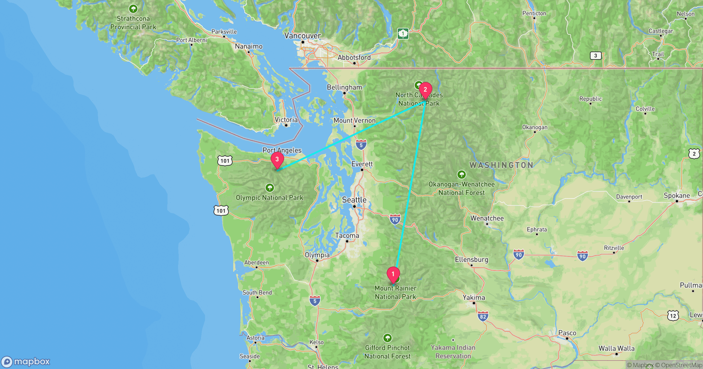
Route at a Glance
| Total driving distance | 390 miles |
| Total driving time | ~9.9 hours (excludes time at each stop and side trips like Sunrise or the Hoh Rainforest) |
| Recommended length | 5-6 days |
| Best season | Early July-September (Mount Rainier's Sunrise road and the North Cascades Highway are the limiting factors) |
| States | Washington (all 3 stops) |
| Entrance fees | $60 total paid individually, or $80 for an annual America the Beautiful pass (only worth it if you're visiting other NPS sites this year) |
Test Yourself
Real NPS photos from these 3 parks, no timer. See if you can tell them apart before you go.
Why This Loop Works
No other national park has Olympic's combination: glacier-capped mountains, old-growth temperate rainforest, and wild Pacific coastline, all inside one boundary. This route builds up to that variety rather than starting with it. Mount Rainier opens the trip with the single most recognizable peak in the Pacific Northwest, an active volcano close enough to see from Seattle. North Cascades follows with a wilder, far less crowded alpine landscape reachable by a two-lane highway. Olympic closes the loop by putting glaciers, rainforest, and coastline within the same day's drive, a combination this route's first two stops don't have on their own.
Mount Rainier National Park
Washington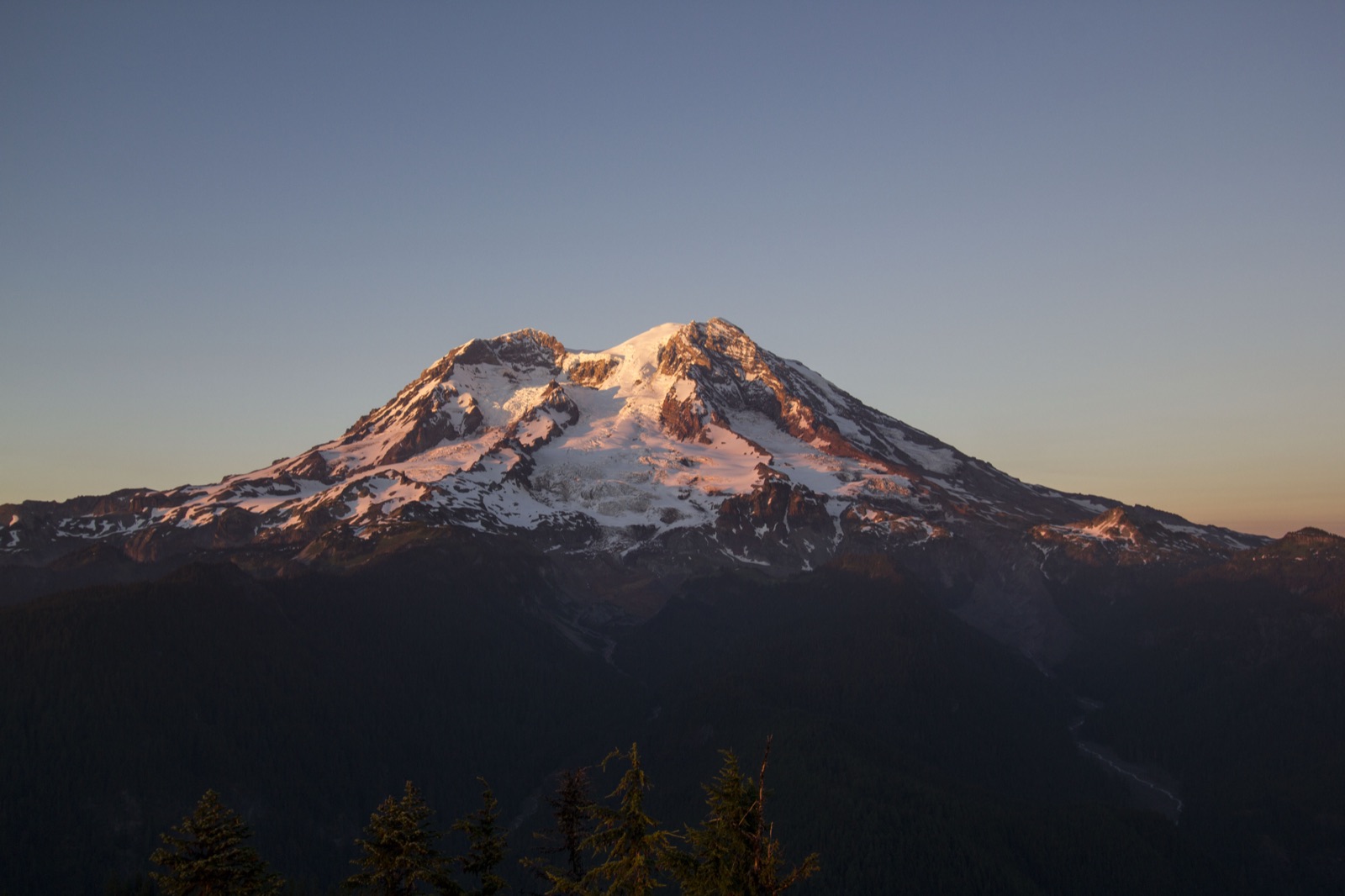
Photo: NPS Photo
- The most heavily glaciated peak in the contiguous US: 25 major glaciers cover more than 35 square miles of the mountain.
- An active volcano, still monitored for eruption hazards by the USGS Cascades Volcano Observatory.
- $30 entrance fee per private vehicle, valid 7 days.
- The Sunrise road, the highest point in the park reachable by car, typically opens by early July and closes again by mid-October; the Paradise road stays open later into the season but gates overnight once snow arrives.
Best for: Subalpine wildflower meadows and glacier views reachable from a paved road, no wilderness permit required
Road conditions: Sunrise, the highest point in the park reachable by car, typically opens by early July and closes again by mid-October; Paradise stays open later into the fall but the road above Longmire gates overnight once snow starts falling.
Next: North Cascades, 217 mi, ~5.1 hr drive
North Cascades National Park
Washington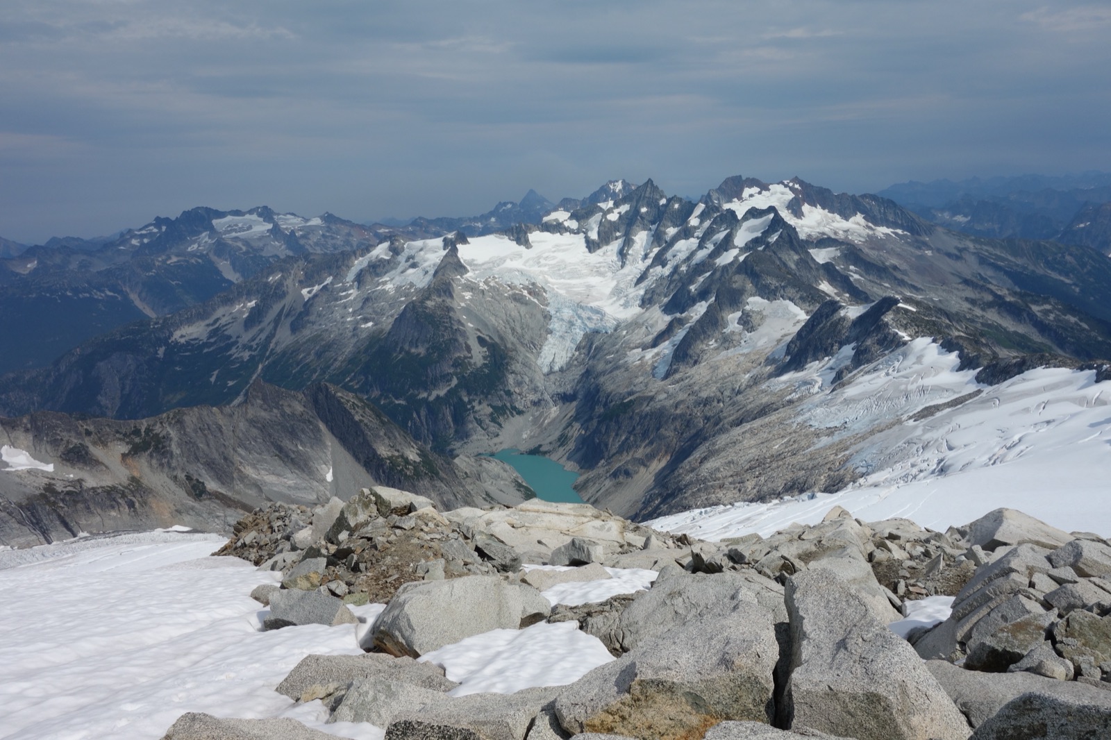
Photo: NPS Photo
- More than 300 glaciers cover its jagged peaks, more than any other park in the Lower 48 outside its Washington neighbors.
- One of the least-visited national parks in the country: North Cascades drew under 50,000 recreational visits in 2025, versus millions each at Mount Rainier and Olympic.
- No entrance fee, one of the few national parks that doesn't charge one.
- State Route 20, the North Cascades Highway, is the only road through the park and closes for winter avalanche danger, typically early December through April; the exact reopening date depends on that year's snowpack.
Best for: Solitude and true alpine wilderness, the least-visited and least-developed stop on this route
Road conditions: State Route 20, the North Cascades Highway, is the only paved road through the park and closes for the winter, typically early December through April, exact dates depend on that year's snowpack. Check WSDOT's mountain pass report before this leg outside of summer.
Next: Olympic, 174 mi, ~4.9 hr drive
Olympic National Park
Washington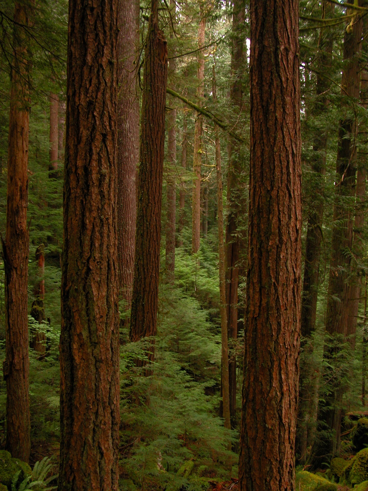
Photo: NPS Photo
- One of the only national parks with glacier-capped mountains, old-growth temperate rainforest, and wild Pacific coastline inside a single boundary.
- Nearly a million acres, protecting ecosystems that barely overlap: alpine peaks, rainforest valleys, and more than 70 miles of undeveloped coast.
- The Hoh Rainforest gets about 140 inches of rain a year, among the wettest spots in the contiguous US.
- $30 entrance fee per private vehicle, valid 7 days.
Best for: Three distinct ecosystems in one visit: alpine peaks, rainforest, and coast
Road conditions: Hurricane Ridge Road can close temporarily for snow and ice even outside of winter, and the Hoh Rainforest and the coastal beaches are separate long detours off Highway 101, not quick stops, budget real time for each.
Frequently Asked Questions
How many days do you need for the Cascades to Coast road trip?
Plan on 5-6 days. The driving between the three park entrances is only about 390 miles and 10 hours total, but that number hides most of what makes this trip worth doing: reaching Sunrise at Mount Rainier, driving the North Cascades Highway's overlooks, and getting out to the Hoh Rainforest or the coast at Olympic all add hours on top of the point-to-point route. A tight 5-day version covers one full day at each park; 6 days lets you add a coastal day at Olympic.
What's the best time of year to drive Cascades to Coast?
Early July through September is the safest window. Mount Rainier's Sunrise road, the highest point in the park reachable by car, usually doesn't open until early July, making it the last of the three parks' high-elevation roads to clear each spring. Late September still has decent weather and thinner crowds, but check current conditions before you go, Pacific Northwest mountain weather can turn quickly even in summer.
Which park on this route has the fewest crowds?
North Cascades, by a wide margin. It's one of the least-visited national parks in the country, drawing under 50,000 recreational visits in 2025 versus millions each at Mount Rainier and Olympic, largely because most of the park is reachable only on foot. The State Route 20 corridor still gives you real alpine views without leaving pavement.
Is the North Cascades Highway open year-round?
No, and this is the one closure to plan the whole trip around. State Route 20, the North Cascades Highway, is the only road through the park and closes for the winter due to snow and avalanche danger, typically early December through April, with the exact reopening date depending on that year's snowpack. Outside that window it's fully open, and driving it is the main reason to visit this stop.
How much does it cost to enter all 3 parks?
$60 total if you pay each park's entrance fee separately: $30 at Mount Rainier, nothing at North Cascades (it's one of the few national parks with no entrance fee), and $30 at Olympic. An America the Beautiful annual pass costs $80, so on this trip alone paying individually is actually cheaper; the pass only pays off if you're visiting other national parks within the same year.
Before You Go
More road trips: see the full National Park Road Trip Guides hub. For broader park comparisons and pre-trip prep, see 7 national parks compared. Test broader park knowledge with the full 50-state Recon Photos game, or check real data for Washington on Fast Facts.