The Geography Traveler
National Park Road Trip Guides
Real driving routes between national parks, not a travel blog's eyeballed itinerary. Every mile below comes from an actual routing calculation, every stop's facts trace back to NPS data, and every route notes the seasonal road closures that could change your trip.
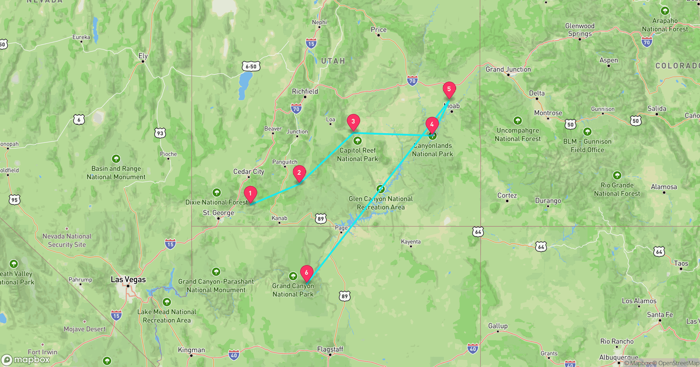
The Grand Circle
SouthwestZion, Bryce Canyon, Capitol Reef, Canyonlands, Arches, Grand Canyon (North Rim)
Five of Utah's Mighty 5 national parks plus the Grand Canyon's quieter North Rim, looped into one drivable route through the highest concentration of national parks anywhere in the country. Zion's slot canyons, Bryce Canyon's hoodoo amphitheater, Capitol Reef's Waterpocket Fold, Canyonlands' river confluences, and Arches' 2,000-plus stone arches all sit within a day's drive of each other, sharing the same red-rock desert geology.
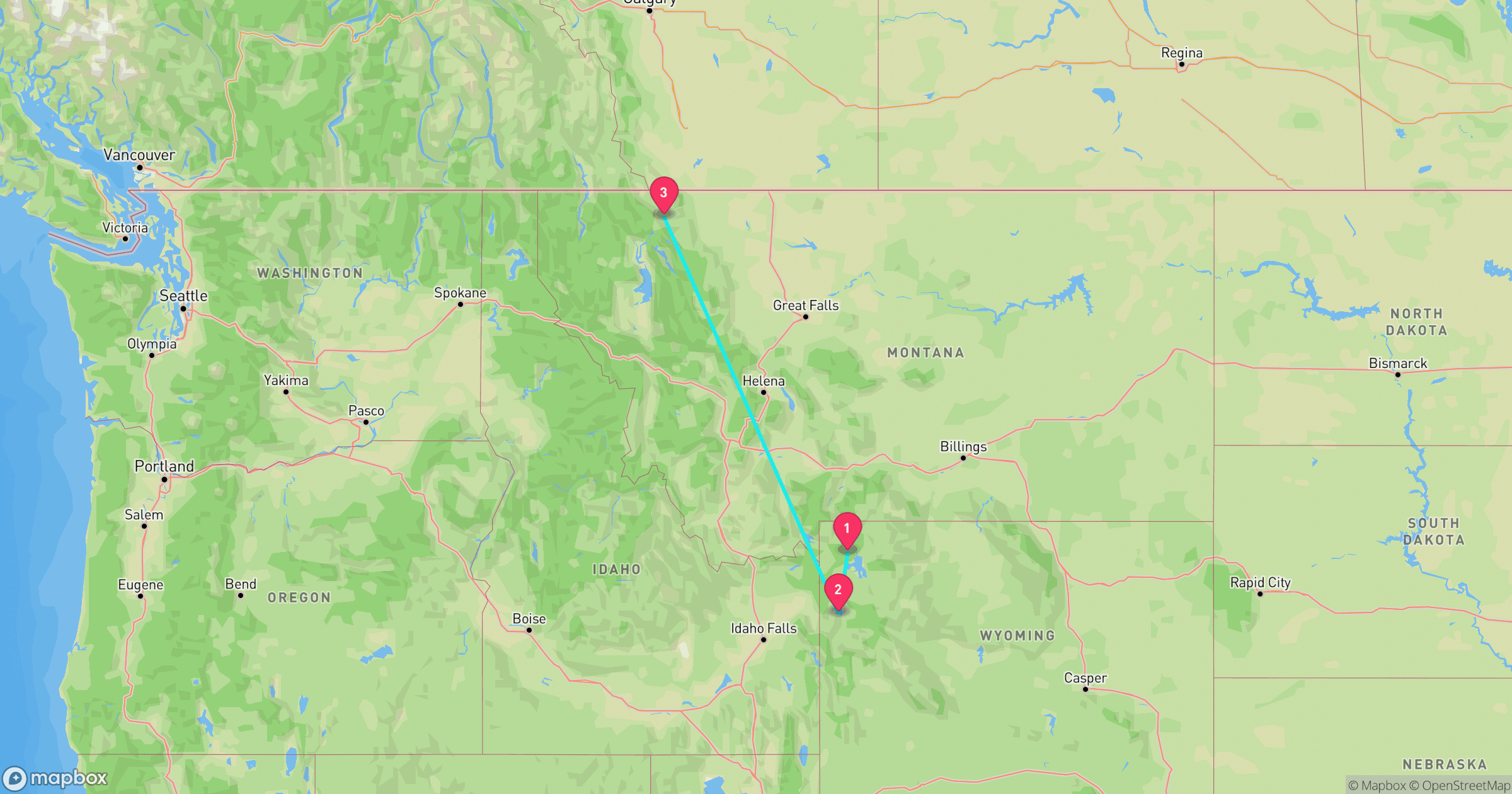
The Going-to-the-Sun Corridor
Northern RockiesYellowstone, Grand Teton, Glacier
Yellowstone and Grand Teton back to back, then north to Glacier along the road that gives this route its name. Yellowstone alone holds over half the world's active geysers, Grand Teton's peaks rise straight from the valley floor with no foothills, and Glacier's Going-to-the-Sun Road, the most dramatic stretch on this route, tops out above 6,600 feet and only fully opens for a few summer months.
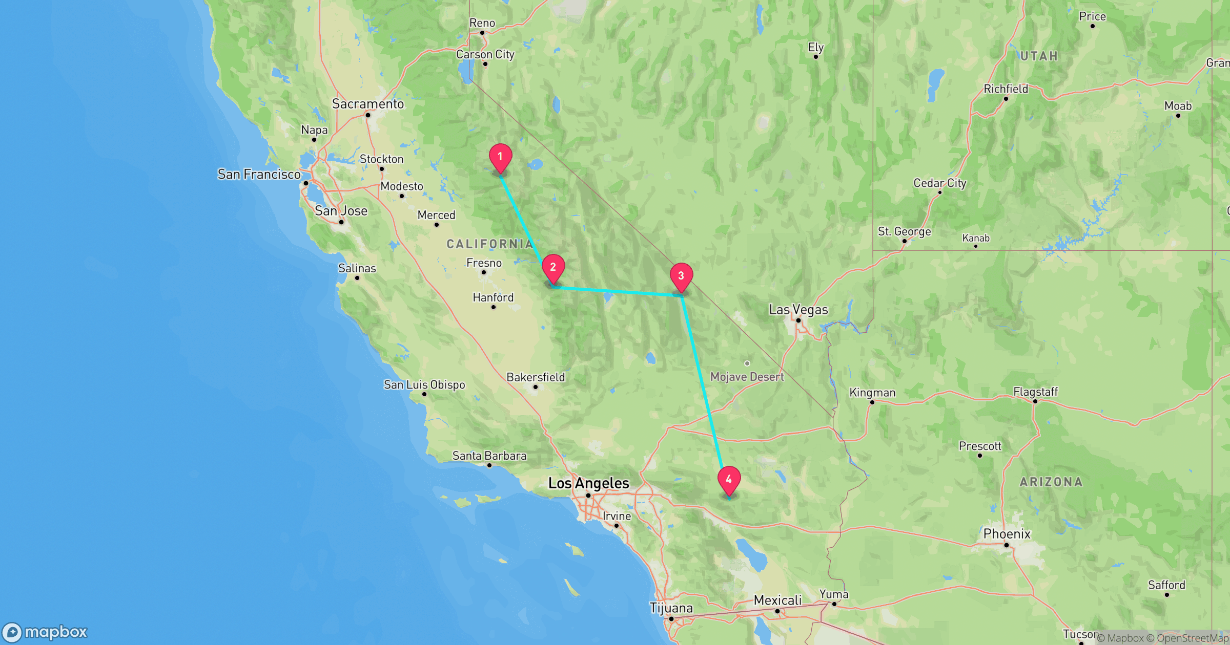
Sierra to Sand
CaliforniaYosemite, Sequoia & Kings Canyon, Death Valley, Joshua Tree
Granite high country down to below-sea-level desert in one California road trip. Yosemite's waterfalls and Half Dome give way to Sequoia and Kings Canyon's giant trees and deep canyons, then the route drops into Death Valley, home to Badwater Basin, the lowest point in North America, before ending at Joshua Tree's boulder fields, the most extreme elevation range of any route in this pillar.
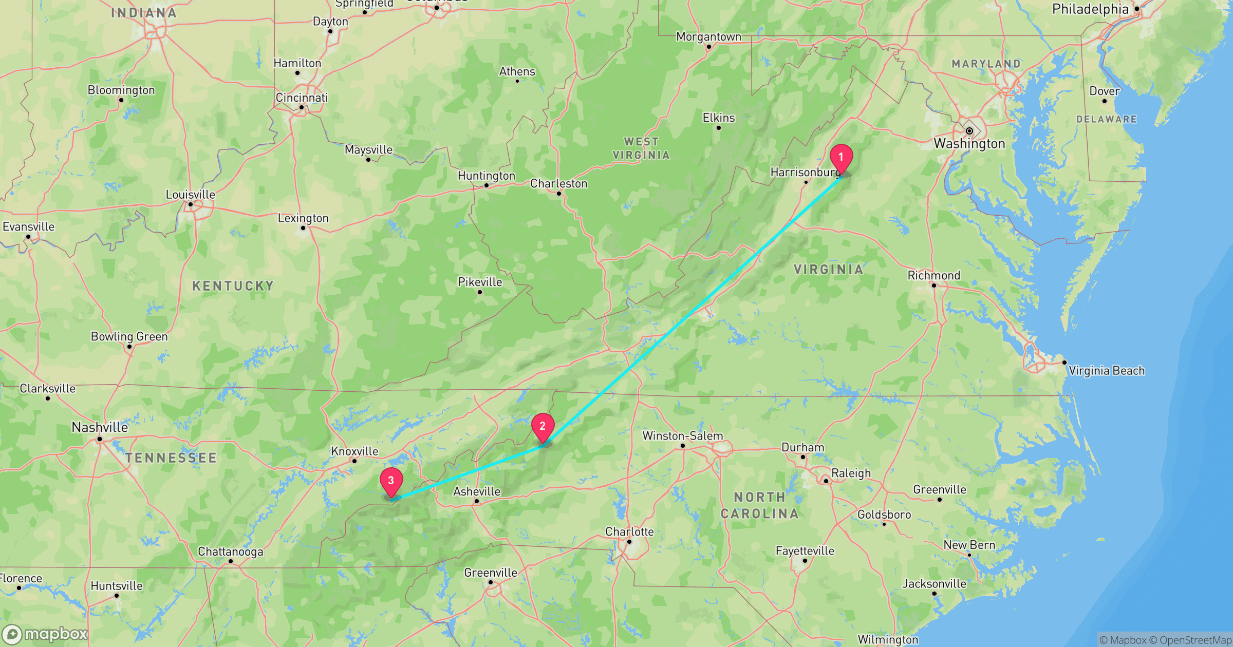
Skyline to Smokies
Southern AppalachiansShenandoah, Blue Ridge Parkway, Great Smoky Mountains
Shenandoah's Skyline Drive into the Blue Ridge Parkway's run through the North Carolina high country, ending at Great Smoky Mountains, the most-visited national park in the country and one of the only major parks with no entrance fee. All three sit along one continuous ridgeline of the southern Appalachians, so this route is really one long mountain drive with three stops along the way.
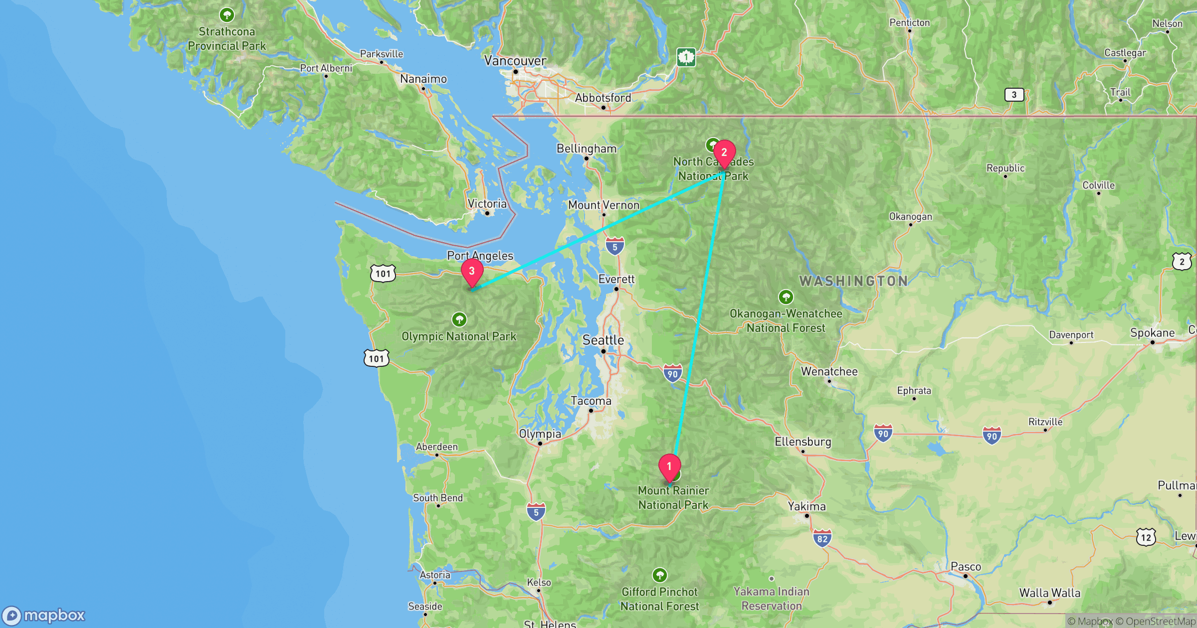
Cascades to Coast
Pacific NorthwestMount Rainier, North Cascades, Olympic
A compact Washington triangle covering volcanic peak, alpine wilderness, and coastline in the shortest drive of any route here. Mount Rainier's glaciated summit, North Cascades' jagged and largely roadless peaks, and Olympic, one of the only parks with glaciers, temperate rainforest, and Pacific coastline inside a single boundary, make this the most geologically varied 390 miles in the entire pillar.
More National Parks
These 5 routes cover 18 national parks and 1 national parkway. For parks not on a route above, see the full national park comparison guide, or test broader park knowledge with the full 50-state Recon Photos game.