August 14, 2026 · The Geography Traveler
The Going-to-the-Sun Corridor: 3 National Parks, 641 Real Miles
This route runs south to north through the Northern Rockies: Yellowstone, the world's first national park and still home to more than half the world's active geysers, then Grand Teton, where the range rises straight out of the valley floor with no foothills in front of it, then a long push north into Montana to close the loop on Glacier and the Going-to-the-Sun Road. Every distance below comes from an actual routing calculation between each stop, not an estimate, and every fact traces back to NPS data.
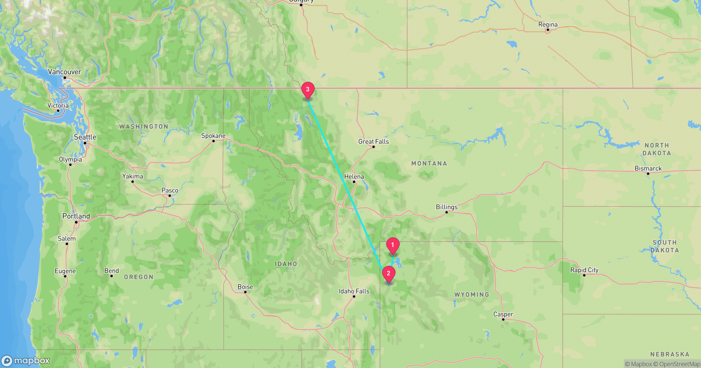
Route at a Glance
| Total driving distance | 641 miles |
| Total driving time | ~12.4 hours (excludes time at each stop) |
| Recommended length | 8-10 days |
| Best season | Late June-mid October (Glacier's Going-to-the-Sun Road typically closed the rest of the year) |
| States | Wyoming (2 stops), Montana (1 stop) |
| Entrance fees | $105 total paid individually, or $80 for an annual America the Beautiful pass |
Test Yourself
Real NPS photos from these 3 parks, no timer. See if you can tell them apart before you go.
Why This Loop Works
Yellowstone and Grand Teton border each other in northwest Wyoming, so the first leg of this route is short, just 83 miles, leaving room for several days in each without burning a travel day in between. Yellowstone alone holds over half the world's active geysers, and its Lamar and Hayden Valleys are two of the most reliable wildlife-watching corridors in the Lower 48. Grand Teton adds a different kind of drama: the Teton Range rises more than 7,000 feet directly from the valley floor, with no foothills to soften the climb, so the mountains look taller than their elevation alone would suggest. The third leg is the long one, a 556-mile push north into Montana, but it ends at Glacier and the Going-to-the-Sun Road, a drive across the Continental Divide that's worth the haul.
Yellowstone National Park
Wyoming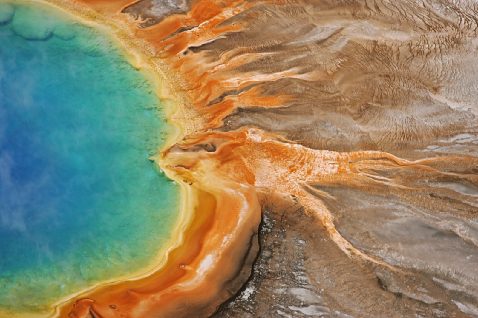
Photo: NPS Photo
- Established March 1, 1872, the world's first national park.
- More than 10,000 hydrothermal features, including over 500 active geysers, more than half of all the geysers on Earth.
- Lamar Valley and Hayden Valley are two of the most reliable wildlife-viewing corridors in the Lower 48, bison, elk, wolves, and grizzlies are regularly seen from the roadside.
- Elevation ranges from 5,282 feet to 11,358 feet at Eagle Peak.
- $35 entrance fee per private vehicle, valid 7 days, and does not carry over to Grand Teton, each park charges its own fee.
Best for: Wildlife-watching corridors and geothermal features, the icon this whole route is built around
Road conditions: Interior park roads are slow by design, narrow, winding, and often behind wildlife traffic jams, budget more driving time than the mileage suggests.
Next: Grand Teton, 83 mi, ~2.2 hr drive
Grand Teton National Park
Wyoming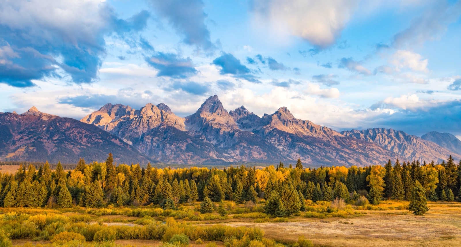
Photo: NPS Photo
- The Teton Range has no foothills, the peaks rise directly out of Jackson Hole's valley floor, which is why they look taller than their actual elevation suggests.
- Grand Teton, the range's tallest peak, tops out at 13,775 feet.
- Established as a smaller park in 1929, then expanded to its present boundaries in 1950 after a decades-long land campaign backed by John D. Rockefeller Jr.
- $35 entrance fee per private vehicle, valid 7 days, separate from Yellowstone's fee even though the two parks border each other.
- Oxbow Bend and String Lake are classic short-walk viewpoints if you only have an hour between Yellowstone and the drive north.
Best for: The most dramatic mountain skyline of the trip, reachable a few miles off the road
Road conditions: US-89/191/26 runs the length of the park and stays open year-round; the scenic Teton Park Road along the base of the range typically closes to cars in winter but reopens each spring.
Next: Glacier, 556 mi, ~10.1 hr drive
Glacier National Park
Montana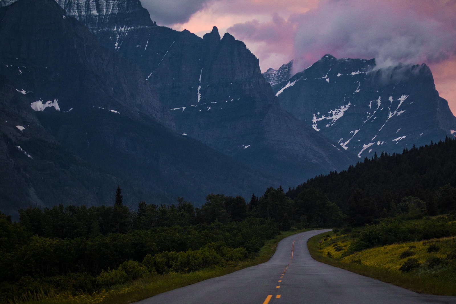
Photo: NPS Photo
- The Going-to-the-Sun Road climbs to 6,646 feet at Logan Pass on the Continental Divide, and is typically fully open, snow-free end to end, only from late June through mid-October; the exact opening date shifts every year with snowpack.
- Of roughly 80 glaciers present in the mid-1800s, about 26 named glaciers remain today.
- Straddles the US-Canada border and forms, together with Canada's Waterton Lakes National Park, the world's first International Peace Park.
- $35 entrance fee per private vehicle in peak season (lower winter rate November 1 to April 30).
- A timed vehicle entry reservation is required for the Going-to-the-Sun Road corridor during peak summer months, check current dates before you go.
Best for: Alpine scenery from the car window, the Going-to-the-Sun Road is one of the most dramatic drives in the park system
Road conditions: The Going-to-the-Sun Road is typically fully open, snow-free end to end, only late June through mid-October; outside that window the route through the park is closed at Logan Pass and you'd detour around the park's southern edge instead.
Frequently Asked Questions
How many days do you need for the Going-to-the-Sun Corridor road trip?
Plan on 8-10 days. The driving alone is about 12.4 hours across 641 miles, but most of that is a single long haul between Grand Teton and Glacier, roughly 556 miles. Give Yellowstone at least 3 days (it's large and the roads are slow), Grand Teton 1-2 days, and Glacier 3-4 days, plus a travel day for the long middle leg.
What's the best time of year to drive this route?
Late June through mid-October is the safest window, because Glacier's Going-to-the-Sun Road is typically only open snow-free end to end during that stretch; the exact opening date shifts every year with snowpack and has ranged from mid-June to late June in recent seasons. Yellowstone and Grand Teton are accessible for more of the year, but this loop's third stop depends on the Sun Road being fully open.
When does the Going-to-the-Sun Road actually open and close each year?
It varies by snowfall, recent seasons have opened anywhere from mid-June to late June and closed in mid-to-late October, sometimes earlier if an early storm hits Logan Pass. Check Glacier National Park's current road status before you go, don't plan around a fixed calendar date.
Which park on this route has the fewest crowds?
All three are heavily visited in peak summer, but Grand Teton sees noticeably fewer visitors than Yellowstone despite sitting right next door, and its short-walk viewpoints like Oxbow Bend and String Lake stay quieter than Yellowstone's geyser basins even in July.
How much does it cost to enter all 3 parks?
$105 per vehicle if you pay each park's entrance fee separately, since Yellowstone and Grand Teton charge separately even though they border each other. An America the Beautiful annual pass is $80 and covers all three (it's valid at any NPS site), so it pays for itself on this route alone.
Before You Go
More road trips: see the full National Park Road Trip Guides hub. For broader park comparisons and pre-trip prep, see 7 national parks compared. Test broader park knowledge with the full 50-state Recon Photos game, or check real data for Wyoming and Montana on Fast Facts.