September 8, 2026 · The Geography Traveler
Sierra to Sand: 4 National Parks, 832 Real Miles
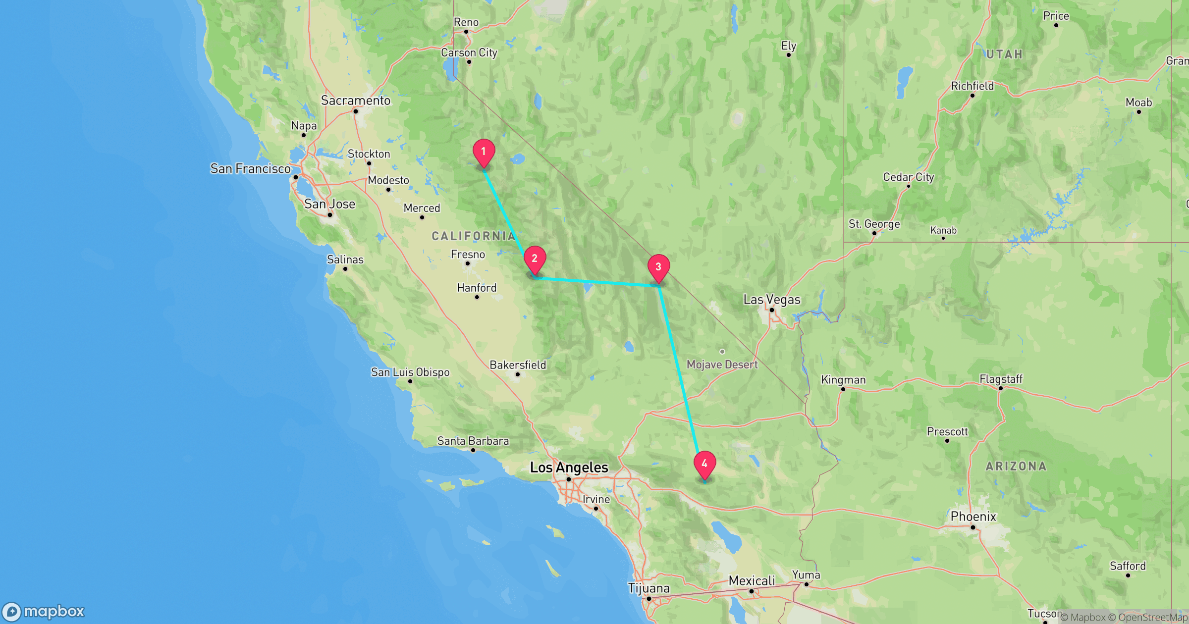
One state, two extremes: this route runs from Yosemite's granite peaks down through Sequoia & Kings Canyon's giant trees, across the Mojave to Death Valley's Badwater Basin, and on to Joshua Tree's desert rock formations. Every distance below comes from an actual routing calculation between each stop, not an estimate, and every fact traces back to NPS data.
Route at a Glance
| Total driving distance | 832 miles |
| Total driving time | ~17.8 hours (excludes time at each stop) |
| Recommended length | 7-9 days |
| Best season | Spring (April-May) or fall (September-October) |
| States | California (all 4 stops) |
| Entrance fees | $130 total paid individually, or $80 for an annual America the Beautiful pass |
Test Yourself
Real NPS photos from these 4 parks, no timer. See if you can tell them apart before you go.
Why This Loop Works
No other single-state road trip covers this much vertical range. Half Dome's summit in Yosemite sits at roughly 8,846 feet; Badwater Basin in Death Valley, the lowest point in North America, sits 282 feet below sea level. That's a swing of more than 9,100 feet between two stops on the same drive, without ever leaving California. The route runs Yosemite to Sequoia & Kings Canyon to Death Valley to Joshua Tree, from granite high country down through the Sierra's giant sequoia groves, out into the Mojave's lowest and hottest ground, and back up into Joshua Tree's higher desert, roughly north to south across the state.
Yosemite National Park
California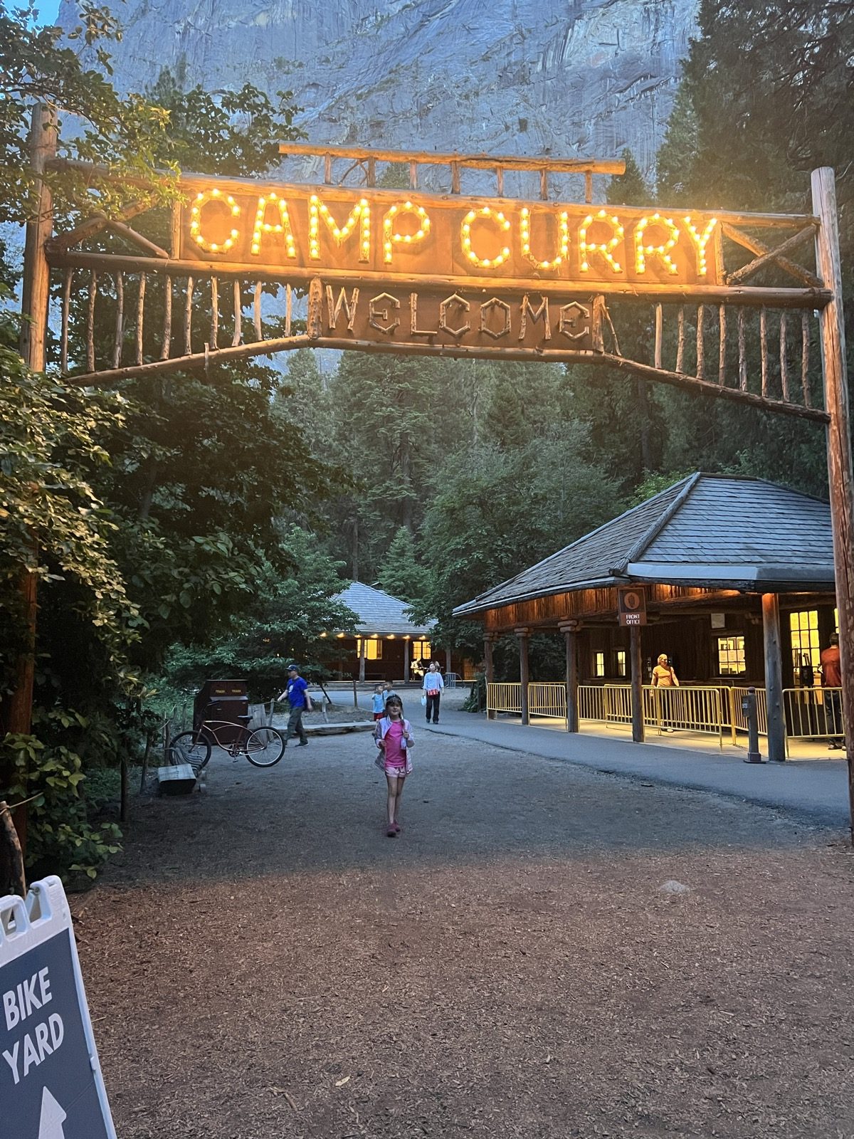
Photo: GeoProwl
- 747,956 acres, nearly 95% of it designated Wilderness.
- Half Dome and El Capitan are sheer granite walls left behind by retreating glaciers.
- Two federally designated Wild & Scenic Rivers — the Tuolumne and the Merced — originate inside the park.
- Designated a UNESCO World Heritage Site in 1984.
- Curry Village, founded in 1899 as a tent camp by David and Jennie Curry, is one of the valley's oldest lodging areas and still rents canvas tent cabins today — it was briefly renamed "Half Dome Village" during a 2016–2019 trademark dispute before the historic Curry Village name was restored.
Best for: Iconic granite views and waterfall hikes, families who don't mind crowds
Road conditions: Yosemite Valley stays open year-round, but Tioga Road (the high-country pass) typically closes with the first heavy snow, usually November, and doesn't reopen until late May or June.
Next: Sequoia & Kings Canyon, 200 mi, ~5.2 hr drive
Read the full Yosemite deep-dive →Sequoia & Kings Canyon National Parks
California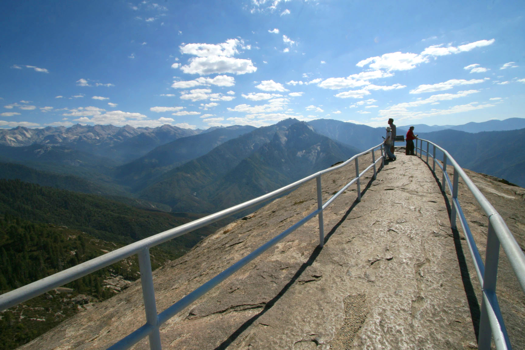
Photo: NPS / Paul Johnson
- Managed as one park, spanning an elevation gradient of more than 13,000 feet.
- Protect more than 200 caves and hold International Biosphere Reserve status.
- The General Sherman Tree: an estimated 52,500 cubic feet in volume, 274.9 feet tall, 102.6 feet around at the base — the largest known living tree on Earth by volume.
- Generally sees far fewer visitors than Yosemite, its neighbor in the same mountain range.
Best for: Giant sequoias, fewer crowds, younger kids who want something tangible
Road conditions: Generals Highway to Giant Forest is open year-round but can require tire chains in winter storms; Kings Canyon's Highway 180 into Cedar Grove closes seasonally, mid-November through mid-April.
Next: Death Valley, 357 mi, ~7.3 hr drive
Read the full Sequoia & Kings Canyon deep-dive →Death Valley National Park
California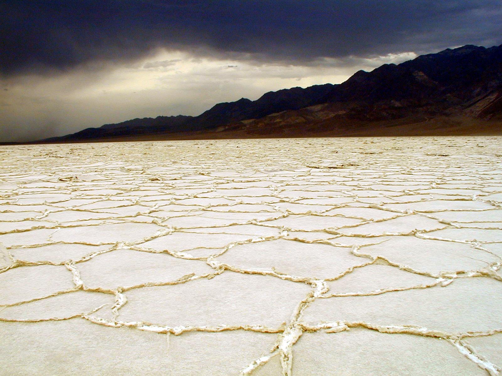
Photo: NPS Photo
- Badwater Basin sits 282 feet below sea level, the lowest point in North America.
- The largest national park in the contiguous United States at 3,422,024 acres, more than four and a half times the size of Yosemite.
- Telescope Peak, the park's high point, tops out at 11,049 feet, more than two vertical miles above Badwater Basin within the same park.
- Holds the record for the hottest air temperature ever reliably recorded on Earth: 134°F at Furnace Creek on July 10, 1913.
- $30 entrance fee per vehicle, valid 7 days.
Best for: Extreme desert scenery, badlands, and the lowest point in North America
Road conditions: Open year-round with no seasonal road closures, but summer heat is a real hazard: highs regularly exceed 115°F, and the NPS advises against hiking after 10am from late spring through early fall.
Next: Joshua Tree, 275 mi, ~5.2 hr drive
Joshua Tree National Park
California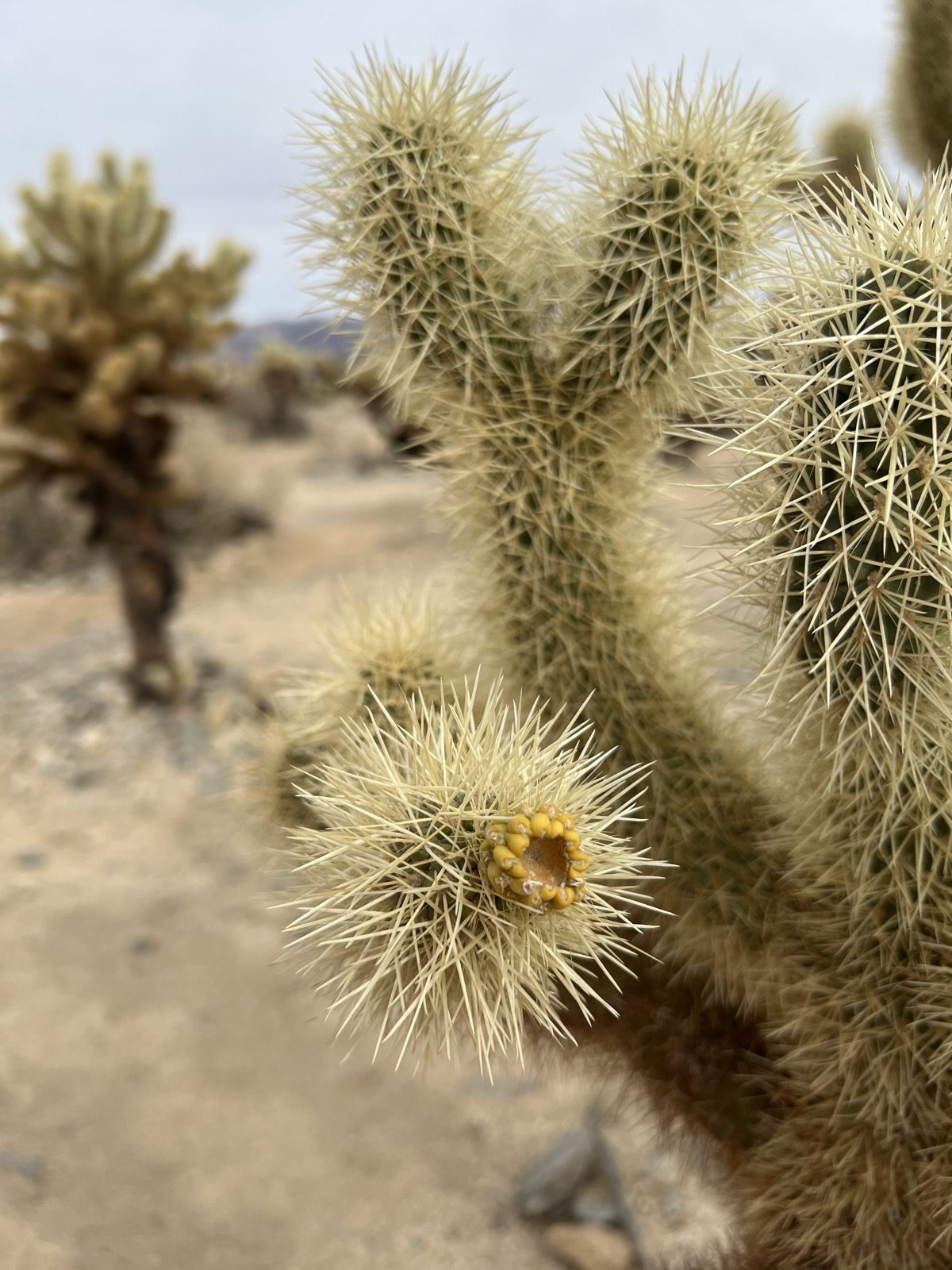
Photo: GeoProwl
- Two distinct desert ecosystems — the Mojave and the Colorado — come together inside the park.
- Elevations range from 900 feet to over 5,000 feet across six distinct mountain ranges.
- Elevated from national monument to national park status on October 31, 1994, as part of the Desert Protection Act, which added 234,000 acres.
- Five palm oases and over three million visitors a year.
Best for: Desert scenery, rock formations, stargazing
Road conditions: Open year-round, no seasonal closures, but there's no fuel inside the park, so fill up before you enter from either the west or north entrance.
Frequently Asked Questions
How many days do you need for the Sierra to Sand road trip?
Plan on 7-9 days. The driving alone is about 18 hours across 832 miles, and the middle leg from Sequoia to Death Valley is a long one at 357 miles, since the Sierra Nevada has no direct road across it in this stretch, so the route has to loop south around the range. A tighter 7-day version means one full day per park; 9 days lets you add a second day at Yosemite or Death Valley.
What's the best time of year to drive Sierra to Sand?
Spring (April-May) or fall (September-October) work best. Death Valley regularly tops 115°F in summer, hot enough to be genuinely dangerous for hiking, while Yosemite and Sequoia's high country can carry snow into late spring. Spring and fall are the two windows where all four parks are comfortable to explore.
Which park on this route has the fewest crowds?
Sequoia & Kings Canyon, generally seeing far fewer visitors than its neighbor Yosemite despite sitting in the same mountain range. Death Valley is the next quietest, its sheer size spreads visitors out even when the park is busy.
How much does it cost to enter all 4 stops?
$130 per vehicle if you pay each park's entrance fee separately ($35 at Yosemite, $35 at Sequoia & Kings Canyon, $30 at Death Valley, $30 at Joshua Tree). An America the Beautiful annual pass is $80 and covers every stop on this route, so it pays for itself by the third park.
How extreme is the elevation range on this trip?
About as extreme as it gets in one state. Half Dome's summit in Yosemite sits at roughly 8,846 feet; Badwater Basin in Death Valley sits at 282 feet below sea level. That's a vertical range of over 9,100 feet between two stops on the same road trip, both in California.
Before You Go
More road trips: see the full National Park Road Trip Guides hub. For broader park comparisons, see 7 national parks compared and the deeper Yosemite vs. Sequoia & Kings Canyon family-trip comparison, which covers the Sierra half of this route in more depth. Test broader park knowledge with the full 50-state Recon Photos game, or check real data for California on Fast Facts.