August 14, 2026 · The Geography Traveler
Skyline to Smokies: 3 Stops, 484 Real Miles
Shenandoah National Park in Virginia, the Blue Ridge Parkway across the North Carolina high country, and Great Smoky Mountains National Park on the Tennessee line: three stops along one continuous ridgeline of the southern Appalachians. Every distance below comes from an actual routing calculation between each stop, not an estimate, and every fact traces back to NPS data.
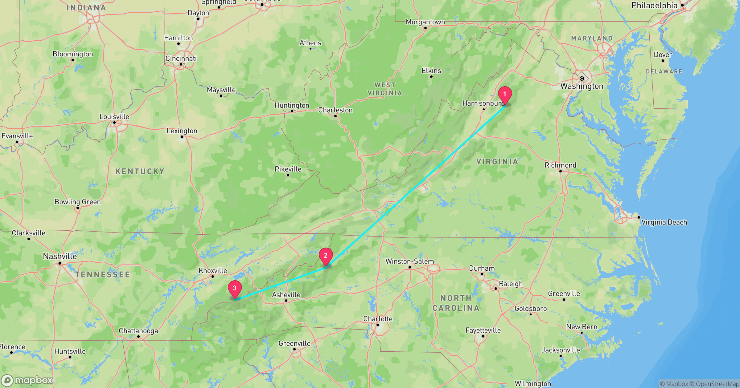
Route at a Glance
| Total driving distance | 484 miles |
| Total driving time | ~9.7 hours (excludes time at each stop) |
| Recommended length | 5-7 days |
| Best season | Late April-October (higher Parkway sections close during winter ice) |
| States | Virginia, North Carolina, Tennessee (one stop each) |
| Entrance fees | Only Shenandoah charges one: $30 per vehicle for 7 days. The Blue Ridge Parkway and Great Smoky Mountains are both free. |
Test Yourself
Real NPS photos from these 3 stops, no timer. See if you can tell them apart before you go.
Why This Route Works
Shenandoah and the Smokies are the two national parks bookending the Blue Ridge Parkway, and the Parkway itself is the only road in the country built specifically to connect two national parks. Together they trace one unbroken ridgeline of the southern Appalachians from northern Virginia into eastern Tennessee. We've covered this corridor before as road history (see the Blue Ridge Parkway's elevation-as-geography story) and as a footpath (the Appalachian Trail through the same mountains). This guide is the version you can actually drive: three stops, real mileage between them, and enough park-by-park detail to plan the trip rather than just read about it.
Shenandoah National Park
Virginia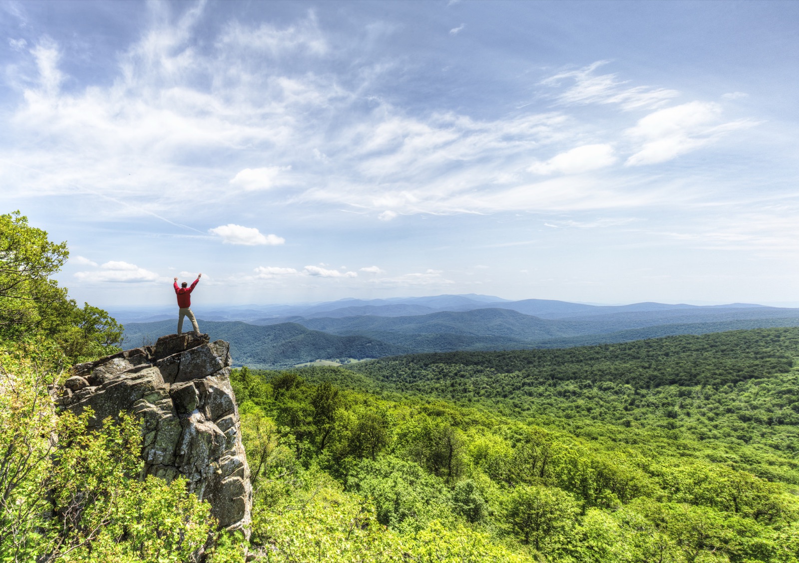
Photo: NPS Photo / Neal Lewis
- Skyline Drive runs the full 105-mile length of the park along the crest of the Blue Ridge, with more than 75 scenic overlooks.
- $30 entrance fee per private vehicle, valid for 7 consecutive days.
- Black bears are common enough that the park posts routine "bear jam" warnings for traffic backups on Skyline Drive.
- Most of the park's forest is regrown: it was farmland and mountain homesteads before the 1930s, and the NPS relocated roughly 500 families to establish the park.
Best for: Ridgeline overlooks and waterfall hikes within easy reach of Washington, D.C.
Road conditions: Skyline Drive has a 35 mph speed limit along its full 105 miles, and higher overlooks can close temporarily during ice or snow, typically November through March.
Next: Blue Ridge Parkway, 327 mi, ~5.9 hr drive
Blue Ridge Parkway (Linn Cove Viaduct)
North Carolina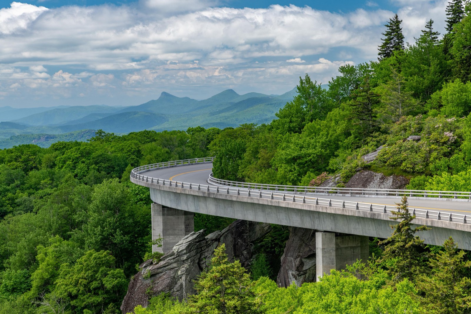
Photo: Harold Blackwood Photo / NPS
- No entrance fee anywhere along its 469 miles, and it's free to drive.
- The most visited unit in the entire National Park System nearly every year since 1946, drawing over 17 million visits annually.
- The Linn Cove Viaduct, completed in 1987, was the last section built. Engineers assembled it from the top down in 1,500 sections to avoid cutting a road scar into Grandfather Mountain's slope.
- The road has no fixed speed limit above 45 mph and closes overnight or in bad weather at higher elevations, it rewards a slow, unhurried pace rather than a fast point-to-point drive.
Best for: The connective drive itself, the highest-elevation, most photographed stretch of the entire parkway
Road conditions: No fixed high speed limit, most sections cap around 45 mph, and the Parkway closes overnight or for days at a time near the Linn Cove Viaduct and other high-elevation sections whenever ice forms. Check the NPS road closure map before you go.
Next: Great Smoky Mountains, 144 mi, ~3.2 hr drive
Great Smoky Mountains National Park
Tennessee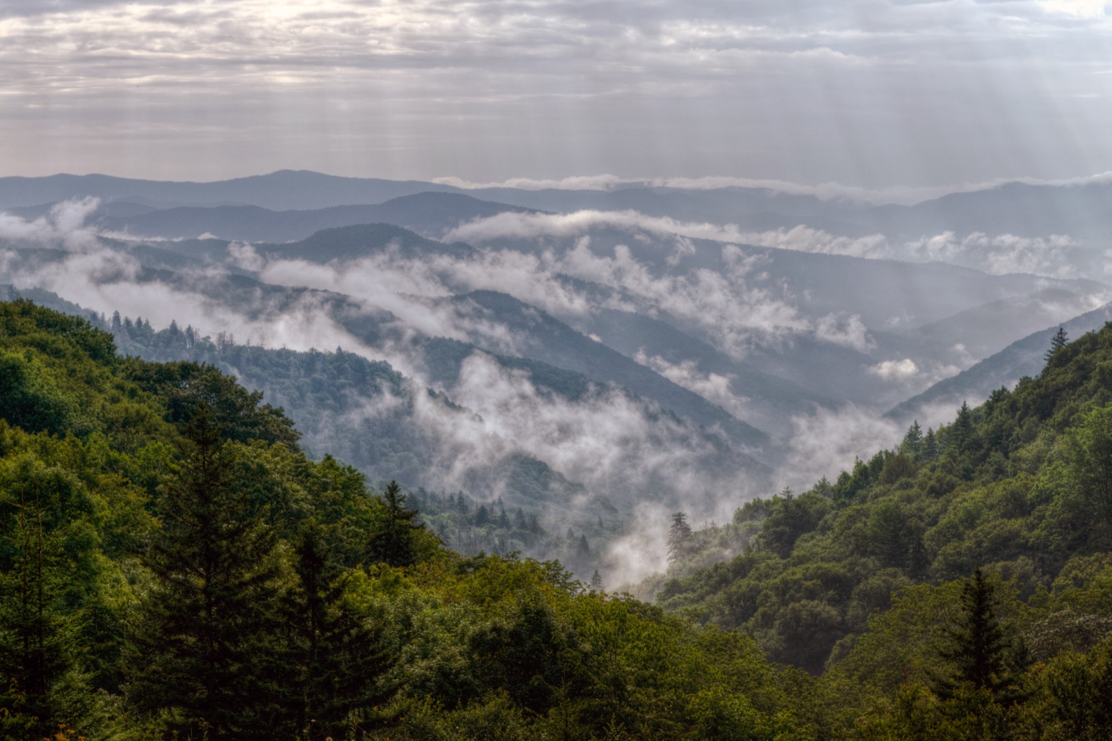
Photo: NPS Photo / Kristina Plaas
- No entrance fee. Congress made this a permanent condition of the land deeds used to assemble the park in the 1930s.
- 12,191,834 recreation visits in 2024, nearly two and a half times Zion's, Yellowstone's, or the Grand Canyon's individual 2024 totals, making it the most visited national park in the country by a wide margin.
- More tree species than all of Northern Europe, and one of the most biologically diverse national parks in the world.
- Straddles the Tennessee-North Carolina border along the crest of the Smokies for over 70 miles, the same ridgeline the Appalachian Trail follows through the park.
Best for: The single most visited national park in America, and one of the only major parks with no entrance fee
Road conditions: Newfound Gap Road, the main route through the park, stays open year-round but can require tire chains during winter storms. Cades Cove Loop Road has seasonal closures and a weekly vehicle-free morning for cyclists and walkers.
Frequently Asked Questions
How many days do you need for the Skyline to Smokies road trip?
Plan on 5-7 days. The driving alone is under 10 hours across 484 miles, short by road-trip standards, but this route is built around slow travel: Skyline Drive and the Blue Ridge Parkway are scenic roads meant to be driven at 35-45 mph with frequent overlook stops, not point A to point B. A tight 5-day version gives you a day at Shenandoah, a day driving the Parkway, and two to three days in the Smokies; 7 days lets you add a second day at either end.
What's the best time of year to drive Skyline to Smokies?
Late April through October covers every stop reliably. Higher sections of the Blue Ridge Parkway, including the stretch around the Linn Cove Viaduct, close overnight or for days at a time whenever ice forms, and Skyline Drive does the same at Shenandoah's higher overlooks. Mid-October is famous for fall color across all three stops, but it's also the single busiest week of the year on the Parkway, so expect overlook traffic.
Which stop on this route has the fewest crowds?
Shenandoah, by a comfortable margin. It draws under 2 million visits a year against the Smokies' more than 12 million, and its 105 miles of Skyline Drive spread visitors out across dozens of overlooks rather than concentrating them at a handful of trailheads.
Is Great Smoky Mountains National Park really free to enter?
Yes. It's one of the only major national parks with no entrance fee at all, a condition written into the land deeds used to assemble the park in the 1930s. The Blue Ridge Parkway is also free to drive. Shenandoah is the only stop on this route that charges an entrance fee, $30 per vehicle for 7 days.
Do you have to drive the entire Blue Ridge Parkway, or just a section?
Just a section. The full Parkway runs 469 miles between Shenandoah and the Smokies, more road than this route needs. This guide treats the drive from Shenandoah down to the Linn Cove Viaduct near milepost 304, one of the most photographed stretches of the whole road, as the Parkway "stop," then connects to the Smokies from there. You can extend onto more of the Parkway if you have the extra days, but you don't need to drive all 469 miles to get the experience.
Before You Go
More road trips: see the full National Park Road Trip Guides hub. For broader park comparisons and pre-trip prep, see 7 national parks compared, plus two related reads on this same corridor: the Blue Ridge Parkway as elevation-as-geography and the Appalachian Trail through these same mountains. Test broader park knowledge with the full 50-state Recon Photos game, or check real data for Virginia, North Carolina, and Tennessee on Fast Facts.