August 14, 2026 · The Geography Traveler
The Grand Circle: 6 National Parks, 919 Real Miles
No other region in the US packs this many national parks into one drivable loop: Zion, Bryce Canyon, Capitol Reef, Canyonlands, and Arches, all in Utah, plus the Grand Canyon's quieter North Rim in Arizona. Every distance below comes from an actual routing calculation between each stop, not an estimate, and every fact traces back to NPS data.
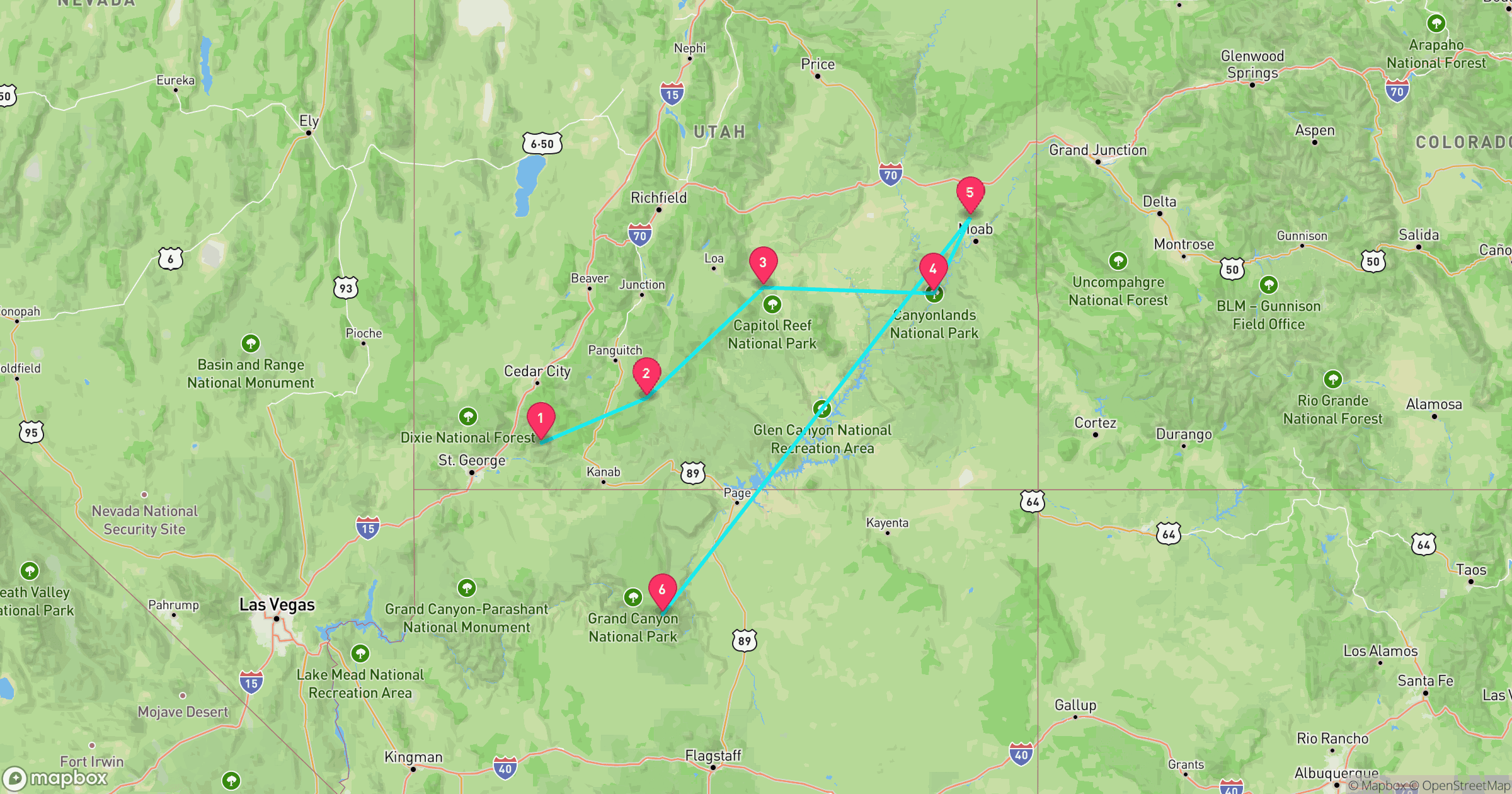
Route at a Glance
| Total driving distance | 919 miles |
| Total driving time | ~18.8 hours (excludes time at each stop) |
| Recommended length | 7-10 days |
| Best season | Late May-early October (North Rim closed the rest of the year) |
| States | Utah (5 stops), Arizona (1 stop) |
| Entrance fees | $185 total paid individually, or $80 for an annual America the Beautiful pass |
Test Yourself
Real NPS photos from these 6 parks, no timer. See if you can tell them apart before you go.
Why This Loop Works
Five of Utah's "Mighty 5" national parks sit within a single day's drive of each other, plus the Grand Canyon's North Rim is close enough to add as a sixth stop without a major detour. The route below runs Zion to Bryce Canyon to Capitol Reef to Canyonlands to Arches to the Grand Canyon, roughly west to east across Utah before dropping south into Arizona, though it works in reverse too.
Zion National Park
Utah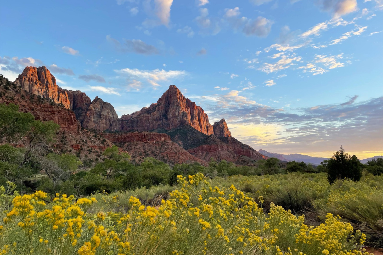
Photo: NPS Photo
- Zion Canyon was carved by the Virgin River, still cutting deeper today.
- The Narrows is one of the few places in the world where the hike is the riverbed itself.
- $35 entrance fee per private vehicle, valid 1-7 days.
- Zion Canyon Scenic Drive is closed to private vehicles most of the year; a park shuttle runs the route instead.
Best for: Slot canyon hikes and dramatic canyon walls, the shortest drive of the loop
Road conditions: Zion Canyon Scenic Drive is shuttle-only most of the year, private vehicles aren't allowed on it; park at the visitor center.
Next: Bryce Canyon, 155 mi, ~3.3 hr drive
Bryce Canyon National Park
Utah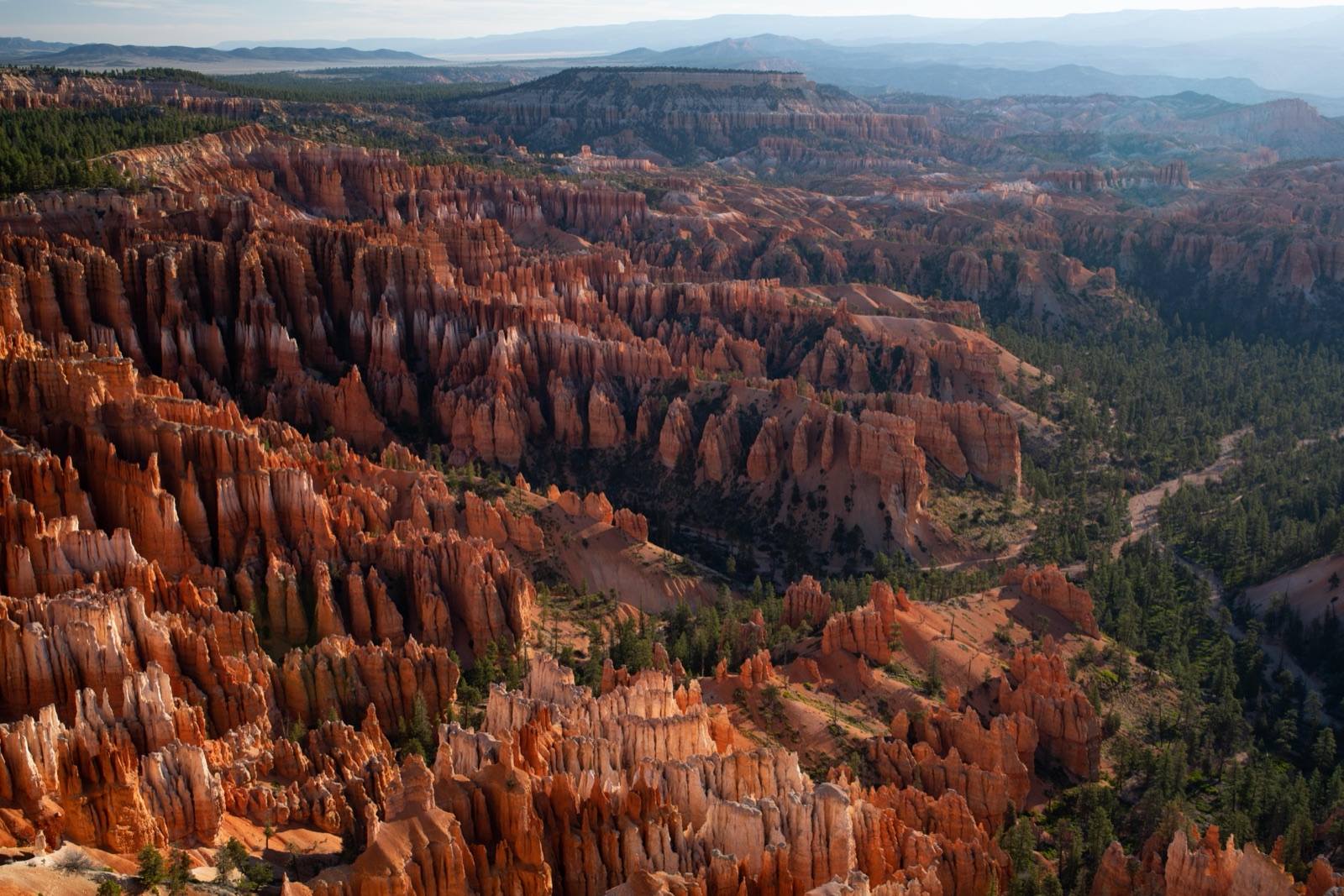
Photo: NPS Photo
- Not a canyon in the geologic sense — it's a series of natural amphitheaters cut into the edge of the Paunsaugunt Plateau.
- Sits at 8,000-9,000 feet elevation, higher than every other stop on this route, which means snow lingers into spring.
- $35 entrance fee per private vehicle.
- Some of the darkest night skies in the National Park System — the park runs its own astronomy program.
Best for: Sunrise photography over the hoodoo amphitheater
Road conditions: Sits above 8,000 feet, the highest stop on this route, so snow can linger into late spring even when the rest of the loop is clear.
Next: Capitol Reef, 124 mi, ~2.9 hr drive
Capitol Reef National Park
Utah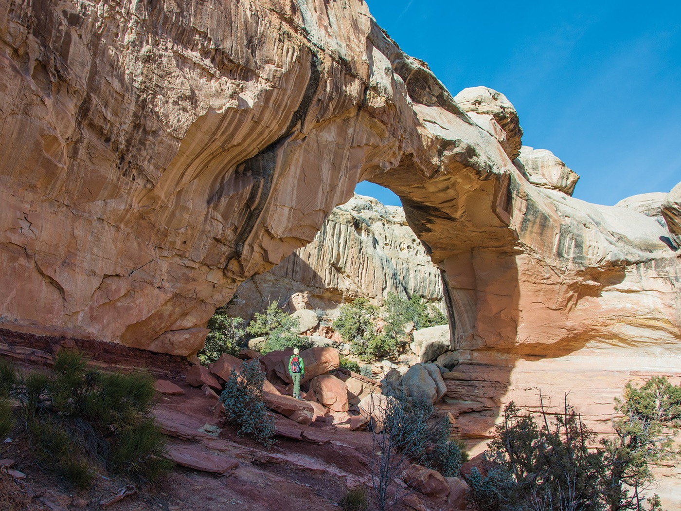
Photo: NPS Photo
- The Waterpocket Fold is a nearly 100-mile-long buckle in the Earth's crust, visible as a single geologic feature from space.
- Fruita, a former Mormon pioneer settlement inside the park, still has working orchards the NPS maintains — visitors can pick fruit in season.
- $20 entrance fee per vehicle, the cheapest of the six stops.
- Named for white sandstone domes that reminded early travelers of the US Capitol building.
Best for: Solitude — the least-visited of the Grand Circle's stops
Road conditions: Highway 24 through the park stays open year-round with no seasonal closures, the easiest stop on this route to reach in any month.
Next: Canyonlands, 169 mi, ~3.2 hr drive
Canyonlands National Park
Utah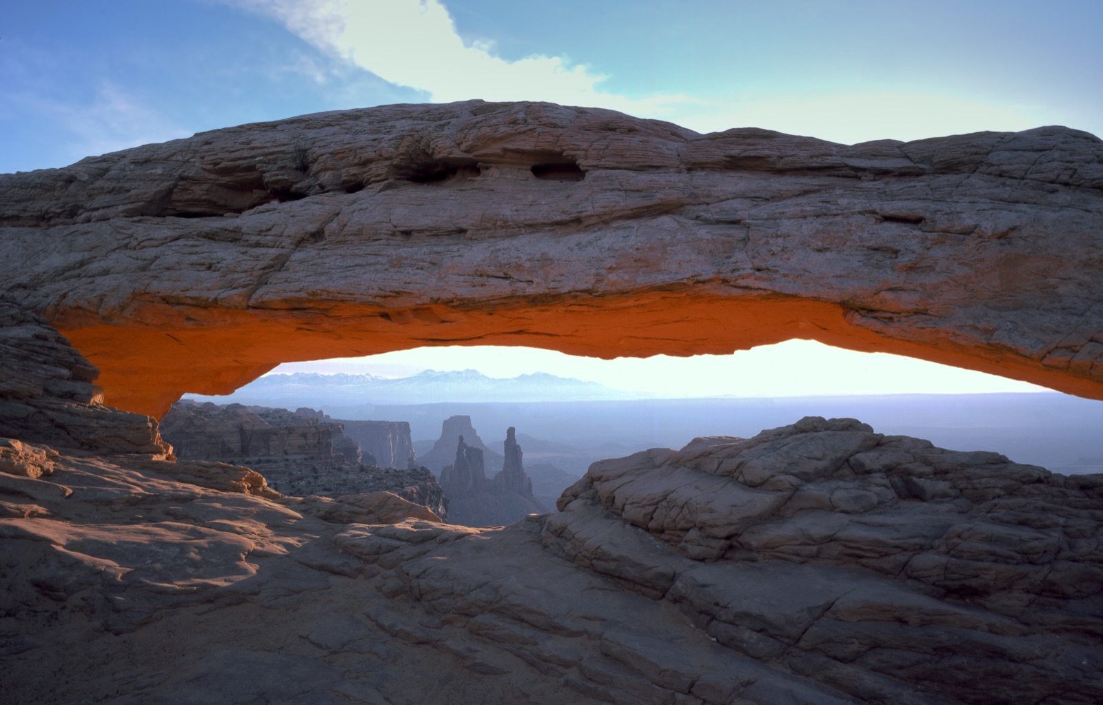
Photo: NPS Photo
- Split into four distinct districts (Island in the Sky, The Needles, The Maze, and the rivers themselves) with no roads connecting them.
- Utah's largest national park, carved entirely by the Green and Colorado Rivers.
- $30 entrance fee per vehicle.
- Most road-trip visitors only see Island in the Sky, the mesa-top district with the easiest access — The Maze requires 4x4 and a permit.
Best for: Backcountry exploration — the park's four districts don't connect by road
Road conditions: The paved Island in the Sky road is open year-round; the unpaved White Rim Road (4x4 only) can wash out after rain and isn't part of this route.
Next: Arches, 55 mi, ~1.4 hr drive
Arches National Park
Utah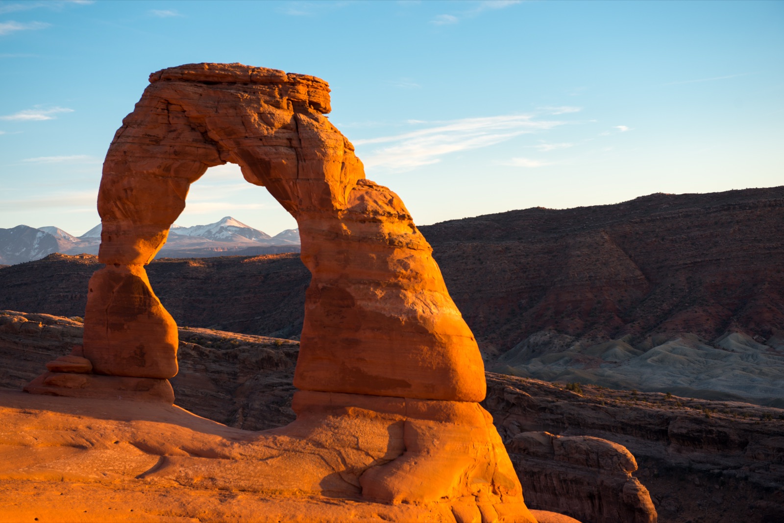
Photo: NPS Photo
- More than 2,000 catalogued natural arches, the highest density anywhere on Earth.
- Delicate Arch, the park's most photographed formation, appears on Utah's license plate.
- $30 entrance fee per vehicle.
- A timed-entry reservation is required for vehicles entering April through October due to visitor volume.
Best for: The highest concentration of natural arches in the world, in a park small enough to see in a day
Road conditions: A timed-entry vehicle reservation is required April through October due to visitor volume, book before you go.
Next: Grand Canyon (North Rim), 409 mi, ~7.5 hr drive
Grand Canyon National Park (North Rim)
Arizona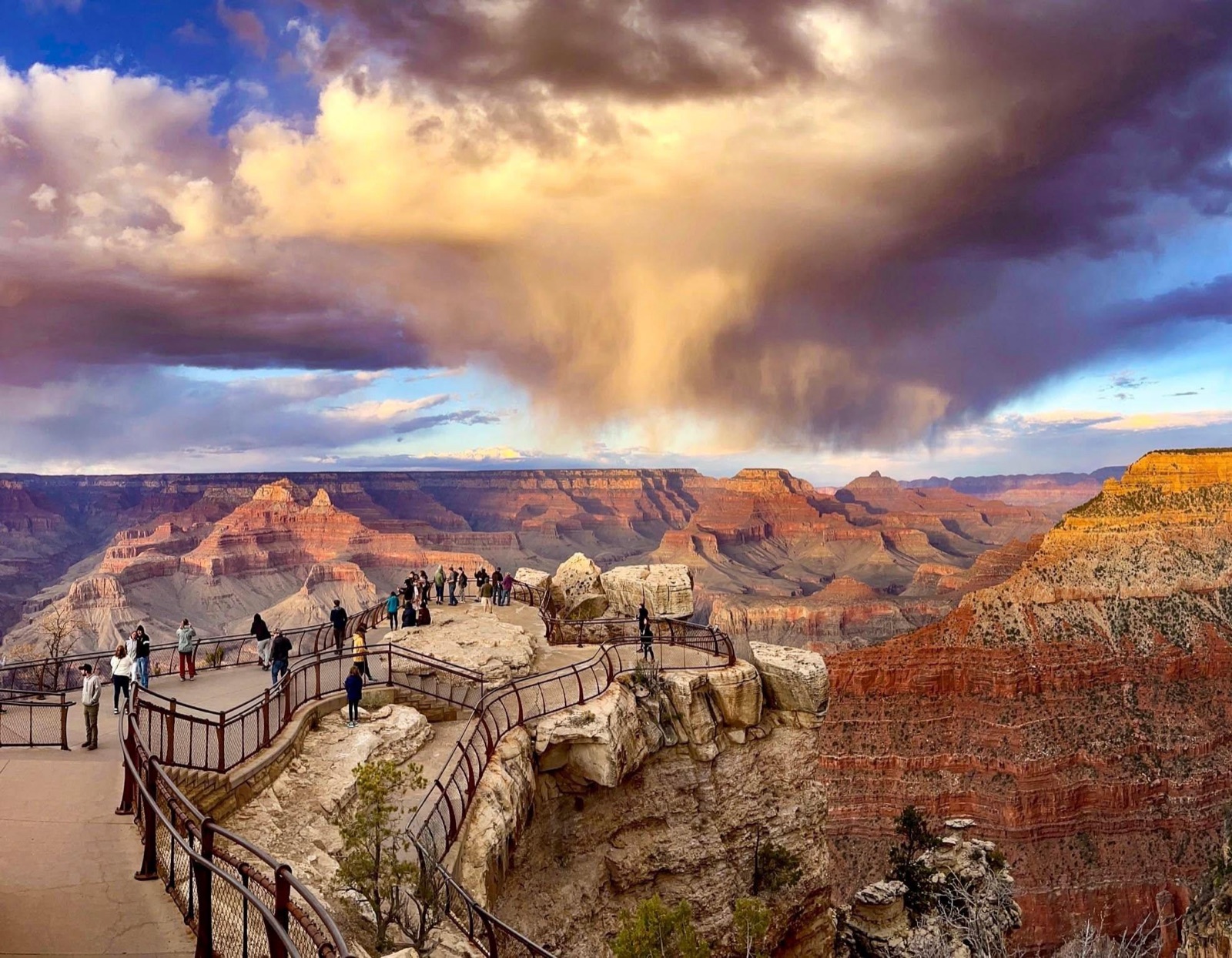
Photo: NPS Photo
- The North Rim draws roughly one-tenth the visitors of the South Rim, despite comparable views.
- Sits above 8,000 feet, about 1,000 feet higher than the South Rim, which means cooler summers and heavier snow.
- $35 entrance fee per vehicle, valid at both rims.
- Closed to vehicles mid-October through mid-May — the road itself gets snowed in.
Best for: Grand Canyon views without South Rim crowds
Road conditions: Closed to vehicles mid-October through mid-May, the road itself gets snowed in. This route only works late May-early October.
Read the full Grand Canyon (North Rim) deep-dive →Frequently Asked Questions
How many days do you need for the Grand Circle road trip?
Plan on 7-10 days. The driving alone is about 19 hours across 919 miles, but this route isn't about driving fast between parks, it's about having a full day (or two) at each stop. A tighter 7-day version means one day per park with a short first and last day; 10 days lets you add a second day at Zion or the Grand Canyon.
What's the best time of year to drive the Grand Circle?
Late May through early October is the only window when every stop is open: the Grand Canyon's North Rim closes to vehicles mid-October through mid-May, so a full loop outside that window means skipping the last stop or driving to the South Rim instead. Late September avoids the biggest summer crowds while keeping the North Rim road open.
Which park on this route has the fewest crowds?
Capitol Reef, by a wide margin. It sits between two more famous stops (Bryce Canyon and Canyonlands) on the same highway, so it's easy to treat as a drive-through, but the Waterpocket Fold and Fruita's historic orchards are worth the same full stop as the others.
Do you need 4x4 for the Grand Circle route?
No. Every park on this route has a paved, standard-vehicle-accessible main road and visitor center, including Canyonlands' Island in the Sky district. 4x4 only matters if you want to go beyond the main road, into Canyonlands' Needles/Maze districts or Capitol Reef's Cathedral Valley, which this route doesn't require.
How much does it cost to enter all 6 stops?
$185 per vehicle if you pay each park's entrance fee separately. An America the Beautiful annual pass is $80 and covers every stop on this route (it's valid at any NPS site), so it pays for itself well before the sixth park.
Before You Go
More road trips: see the full National Park Road Trip Guides hub. For broader park comparisons and pre-trip prep, see 7 national parks compared, 7 map-reading games for the drive, and the Grand Canyon geography quiz. Test broader park knowledge with the full 50-state Recon Photos game, or check real data for Utah and Arizona on Fast Facts.